File:Orange River, South Africa (MODIS 2016-03-14).jpg

Original file (3,300 × 2,540 pixels, file size: 987 KB, MIME type: image/jpeg)
Captions
Captions
Summary
edit.jpg&action=edit§ion=1)
| Description |
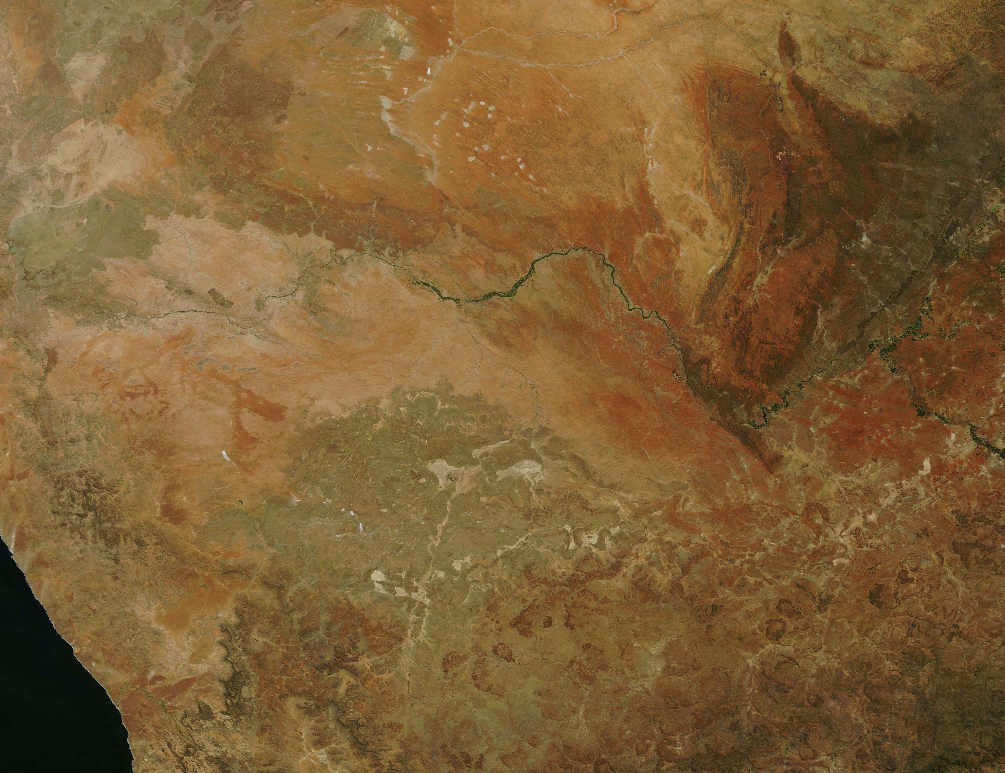
English: On February 27, 2016, the Moderate Resolution Imaging Spectroradiometer (MODIS) aboard NASA�s Terra satellite flew across northwestern South Africa and acquired this stunning true-color image.
The spectacular ochres, reds and tans of the Northern Cape are created by the arid climate and rugged landscape. Washes of light green indicate areas where soil moisture allows vegetative growth. The greenest feature of the region is the Orange River, which snakes across the image, flowing from the east to the west. The Orange River is the longest river in South Africa, twisting its way over 2,200 kilometers (1,367 miles) between the headwaters in Lesotho and the Atlantic Ocean. The Orange River basin drains approximately 1,000,000 square km (386,102 sq mi), including parts of Botswana, Lesotho, Namibia and South Africa. A little more than sixty-four percent of the basin lies in South Africa, and South Africa also is responsible for ninety-seven percent of the water use from the River. Agriculture, industry and domestic needs are the primary uses for water from the Orange River. The River crosses six provinces in South Africa, and, in the west, forms the boundary between South African and Namibia. As in any arid region, a river becomes a cherished feature as it carries life-sustaining water. Because the Orange River has proven so important to so many peoples through history, it naturally acquired a number of names. In pre-colonial times, the inhabitants called the river Gariep. In 1779 Colonel Robert Gordon of the Dutch East India Company re-named the river the Orange, in honor of William V of Orange. Since the end of apartheid, the name Gariep has become more popular in much of South Africa. The Eastern Cape Geographical Names Committee has been considering changing the name of the part of the river that borders the South African provinces of Eastern Cape and the Free State, suggesting IGqili or Sengu, but there are opponents of the name change. At the headwaters in Lesotho the Orange known as the Sengu River, and some sources use the name Orange-Sengu River. |
||
| Date | Taken on 27 February 2016 | ||
| Source |
Orange River, South Africa (direct link)
|
||
| Author | Jeff Schmaltz, MODIS Land Rapid Response Team, NASA GSFC |
| This media is a product of the Terra mission Credit and attribution belongs to the mission team, if not already specified in the "author" row |
Licensing
edit.jpg&action=edit§ion=2)
| This file is in the public domain in the United States because it was solely created by NASA. NASA copyright policy states that "NASA material is not protected by copyright unless noted". (See Template:PD-USGov, NASA copyright policy page or JPL Image Use Policy.) | ||
 |
Warnings:
|
File history
Click on a date/time to view the file as it appeared at that time.
| Date/Time | Thumbnail | Dimensions | User | Comment | |
|---|---|---|---|---|---|
| current | 19:42, 15 February 2024 | | 3,300 × 2,540 (987 KB) | OptimusPrimeBot (talk | contribs) | #Spacemedia - Upload of http://modis.gsfc.nasa.gov/gallery/images/image03142016_250m.jpg via Commons:Spacemedia |
You cannot overwrite this file.
File usage on Commons
There are no pages that use this file.
.jpg&oldid=891797820)