File:Orbis terrarum typus de integro multis in locis emendatus - Norman B. Leventhal Map Center at the BPL.jpg
Original file (2,000 × 1,424 pixels, file size: 3.17 MB, MIME type: image/jpeg)
Captions
Captions
Summary
edit
| Description |
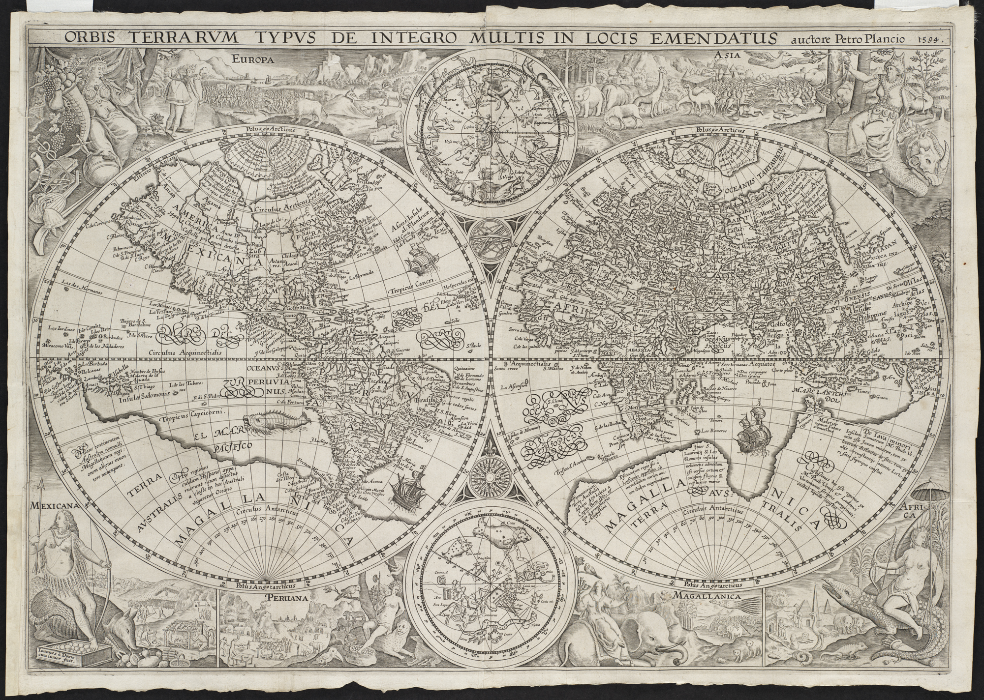
Zoom into this map at maps.bpl.org. Author: Plancius, Petrus Publisher: Petrus Plancius Date: [1594]
As was fairly common during the Golden Age of Dutch Cartography, this map projects the world on two hemispheres Eastern and Western. It was the first richly decorated map of the period and influenced the art of cartography for the next century. Using female figures and animals representative of the respective regions, the decorative borders symbolize the six continents. Europe and Asia pictured as fully clothed figures were placed at the top of the map, expressing their superior culture and dominance over the rest of the world. The other continents Mexicana (North America), Peruana (South America), Magallanica (the still hypothetical Antarctica), and Africa were placed at the bottom suggesting their inferior status. Plancius, the creator of this world map, was a Flemish astronomer, geographer, and theologian. He also served as a cartographer for the Dutch East India Company. |
| Date | |
| Source | Orbis terrarum typus de integro multis in locis emendatus |
| Author | http://maps.bpl.org |
Licensing
edit
- You are free:
- to share – to copy, distribute and transmit the work
- to remix – to adapt the work
- Under the following conditions:
- attribution – You must give appropriate credit, provide a link to the license, and indicate if changes were made. You may do so in any reasonable manner, but not in any way that suggests the licensor endorses you or your use.
| This image was originally posted to Flickr by Norman B. Leventhal Map Center at the BPL at https://www.flickr.com/photos/24528911@N05/2675671332. It was reviewed on 2 July 2012 by FlickreviewR and was confirmed to be licensed under the terms of the cc-by-2.0. |
File history
Click on a date/time to view the file as it appeared at that time.
| Date/Time | Thumbnail | Dimensions | User | Comment | |
|---|---|---|---|---|---|
| current | 01:44, 2 July 2012 | | 2,000 × 1,424 (3.17 MB) | Dzlinker (talk | contribs) | == {{int:filedesc}} == {{Information |Description=Zoom into [http://maps.bpl.org/id/10024 this map] at [http://maps.bpl.org maps.bpl.org]. '''Author:''' Plancius, Petrus '''Publisher:''' Petrus Plancius '''Date:''' [1594] '''Scale:''' Scale [ca. 1:10... |
You cannot overwrite this file.
File usage on Commons
There are no pages that use this file.