File:Ordnance Survey Drawings - Axbridge (OSD 49).jpg

Size of this preview: 800 × 593 pixels. Other resolutions: 320 × 237 pixels | 640 × 474 pixels | 1,024 × 759 pixels | 1,280 × 949 pixels | 2,560 × 1,897 pixels | 5,056 × 3,747 pixels.
Original file (5,056 × 3,747 pixels, file size: 5.31 MB, MIME type: image/jpeg)
Captions
Captions
Add a one-line explanation of what this file represents
| Axbridge (OSD 49)
|
|||||
|---|---|---|---|---|---|
| Title |
Ordnance Survey Drawings: Axbridge (OSD 49) |
.jpg) | |||
| Object type |
manuscript map |
||||
| Description |
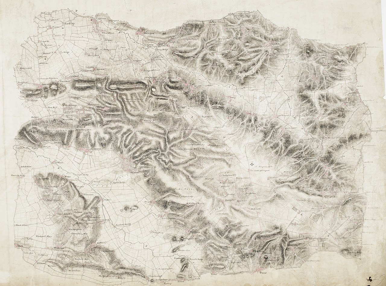
 Centre of map shown on a map of England
English: This drawing covers the Mendip Hills, from Wrington to Wells. Pencil rays extend from the left of the map towards Red Hill, on the right, and Mark and Tillham, on the bottom right. The draughtsman used these lines to measure relative distance and to plot locations by triangulation. Masberry Castle is shown in the bottom right, on top of a hill whose steepness is indicated by soft brushwork interlining ('hachuring'). The castle path joins the main turnpike road, whose length is annotated at intervals of one mile. Many field boundaries are marked in red, denoting stone walls rather than corrections in this case..
This image has been georeferenced.
|
||||
| Language |
English |
||||
| Date | 1811 | ||||
| Medium | Pen and ink on paper | ||||
| Dimensions | height: 290 mm (11.41 in); width: 400 mm (15.74 in) | ||||
| Collection | |||||
| Accession number |
Maps OSD 49 |
||||
| Credit line | British Library | ||||
| Notes |
Scale 2 inches : 1 mile ( 1: 31680). Please note that the British Library provides these digital files "as-is"; materials will not be rephotographed under this programme. If resupply of files is required, the requestor will be required to purchase them at the standard rate. |
||||
| References |
http://www.bl.uk/onlinegallery/onlineex/ordsurvdraw/a/002osd000000007u00034000.html (English) |
||||
| Source/Photographer |
|
||||
| Permission (Reusing this file) |
|
||||


_(St_Edwards_Crown).svg)
.jpg¶ms=51.291676_N_-2.711278_E_)
.jpg¶ms=51.20159_N_-2.904017_E_)
.jpg¶ms=51.381762_N_-2.51854_E_)
.jpg¶ms=51.380986_N_-2.903633_E_)
.jpg¶ms=51.202367_N_-2.518924_E_)
File history
Click on a date/time to view the file as it appeared at that time.
| Date/Time | Thumbnail | Dimensions | User | Comment | |
|---|---|---|---|---|---|
| current | 21:37, 26 September 2013 | | 5,056 × 3,747 (5.31 MB) | LibraryBot (talk | contribs) | {{subst:User:Andrew Gray/OSD|ID= 002OSD000000007U00034000 |OSD_NUM= OSD 49 |MEDIUM= Pen and ink on paper |TITLE= Axbridge |CREATOR= |YEAR= 1811 |DESCRIPTION= This drawing covers the Mendip Hills, from Wrington to Wells. Pencil rays extend from the lef... |
You cannot overwrite this file.
File usage on Commons
The following page uses this file:
File usage on other wikis
The following other wikis use this file:
- Usage on www.wikidata.org
.jpg&oldid=670623228)