File:Ordnance Survey Drawings - Swansea (Abertawe) (OSD 179).jpg

Size of this preview: 800 × 437 pixels. Other resolutions: 320 × 175 pixels | 640 × 350 pixels | 1,024 × 559 pixels | 1,280 × 699 pixels | 2,560 × 1,398 pixels | 5,792 × 3,163 pixels.
Original file (5,792 × 3,163 pixels, file size: 3.57 MB, MIME type: image/jpeg)
Captions
Captions
Add a one-line explanation of what this file represents
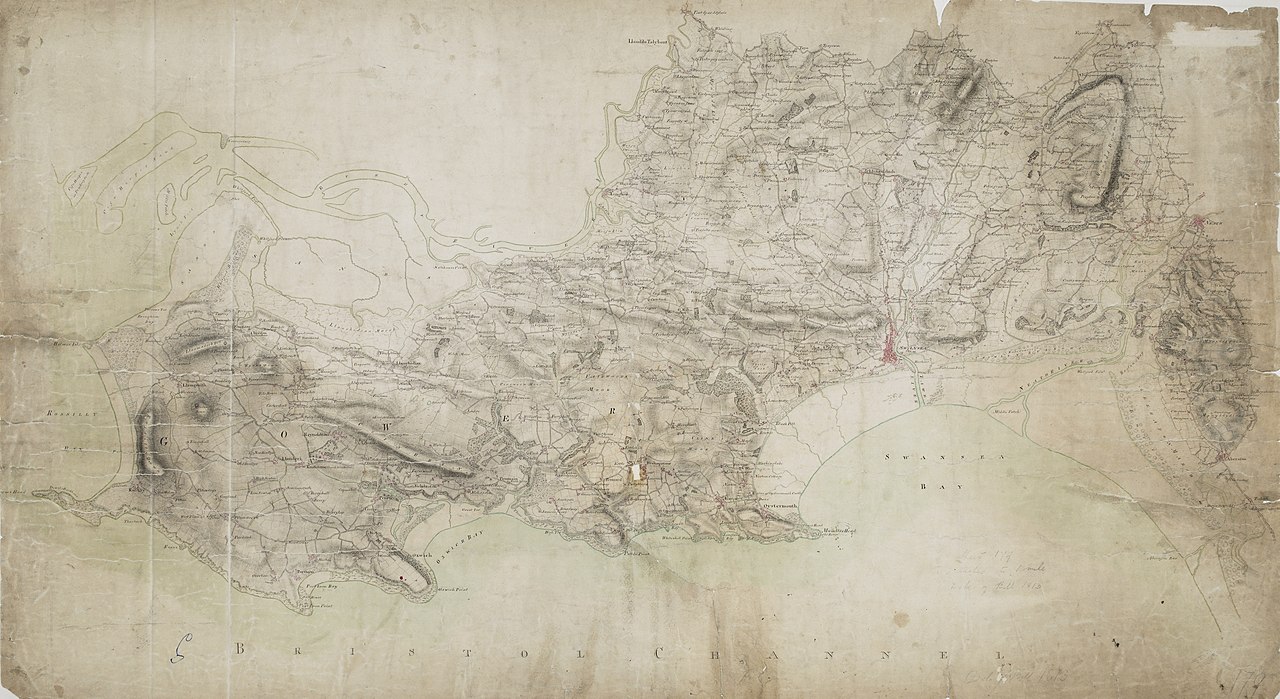
| Swansea (OSD 179)
|
|||||
|---|---|---|---|---|---|
| Artist |
[Budgen, Thomas] - Draughtsman |
_(OSD_179).jpg) | |||
| Title |
Ordnance Survey Drawings: Swansea (Abertawe) (OSD 179) |
||||
| Object type |
manuscript map |
||||
| Description |
 Centre of map shown on a map of England
English: This plan of the Gower peninsula and Swansea Bay shows the contemporary development of Swansea harbour at the mouth of the River Towe. It also details the canals connecting this tidal port to the coalfields of the Swansea Valley and to Llansamlet, where coal had been worked extensively since the 18th century..
This image has been georeferenced.
|
||||
| Language |
English |
||||
| Date | 1813 | ||||
| Medium | Pen and ink on paper | ||||
| Dimensions | height: 310 mm (12.20 in); width: 530 mm (20.86 in) | ||||
| Collection | |||||
| Accession number |
Maps OSD 179 |
||||
| Credit line | British Library | ||||
| Notes |
Scale 2. Please note that the British Library provides these digital files "as-is"; materials will not be rephotographed under this programme. If resupply of files is required, the requestor will be required to purchase them at the standard rate. |
||||
| References |
http://www.bl.uk/onlinegallery/onlineex/ordsurvdraw/s/002osd000000021u00135000.html (English) |
||||
| Source/Photographer |
|
||||
| Permission (Reusing this file) |
|
||||


.svg)
_(OSD_179).jpg¶ms=51.617931_N_-4.056724_E_)
_(OSD_179).jpg¶ms=51.505244_N_-4.362972_E_)
_(OSD_179).jpg¶ms=51.730617_N_-3.750477_E_)
_(OSD_179).jpg¶ms=51.707706_N_-4.362972_E_)
_(OSD_179).jpg¶ms=51.505244_N_-4.34273_E_)
_(OSD_179).jpg¶ms=51.528155_N_-3.750477_E_)
_(OSD_179).jpg¶ms=51.730617_N_-3.770718_E_)
File history
Click on a date/time to view the file as it appeared at that time.
| Date/Time | Thumbnail | Dimensions | User | Comment | |
|---|---|---|---|---|---|
| current | 08:40, 26 September 2013 | | 5,792 × 3,163 (3.57 MB) | LibraryBot (talk | contribs) | {{subst:User:Andrew Gray/OSD|ID= 002OSD000000021U00135000 |OSD_NUM= OSD 179 |MEDIUM= Pen and ink on paper |TITLE= Swansea (Abertawe) |CREATOR= [Budgen, Thomas] - Draughtsman |YEAR= 1813 |DESCRIPTION= This plan of the Gower peninsula and Swansea Bay sho... |
You cannot overwrite this file.
File usage on Commons
The following page uses this file:
File usage on other wikis
The following other wikis use this file:
- Usage on www.wikidata.org
_(OSD_179).jpg&oldid=713427733)