File:Ordnance Survey Plate 9 Index Scotland.jpg
Size of this preview: 436 × 599 pixels. Other resolutions: 175 × 240 pixels | 349 × 480 pixels | 559 × 768 pixels | 745 × 1,024 pixels | 1,491 × 2,048 pixels | 5,348 × 7,346 pixels.
Original file (5,348 × 7,346 pixels, file size: 3.34 MB, MIME type: image/jpeg)
Captions
Captions
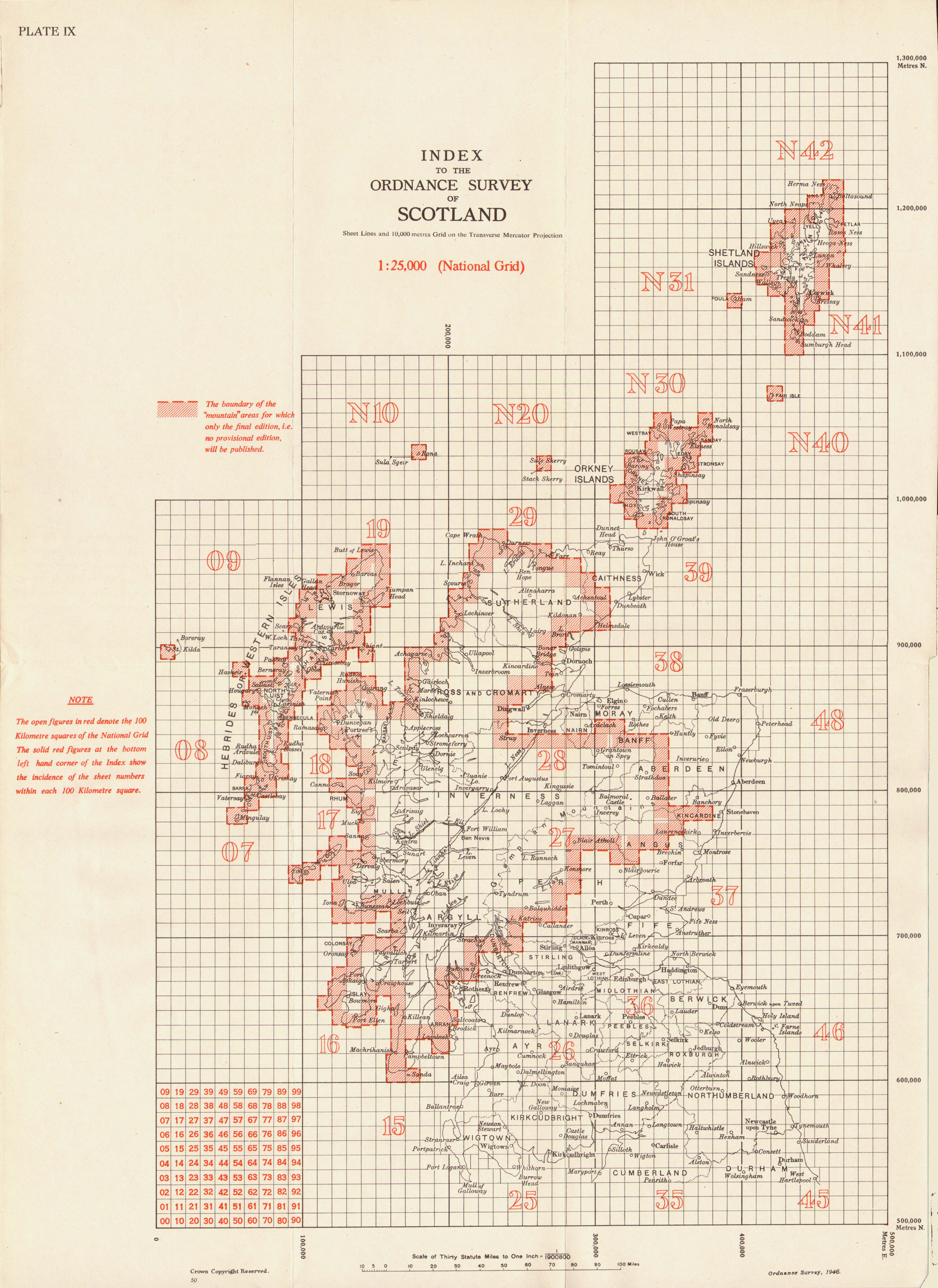
Index to 1:25000 OS maps, Scotland
Summary
edit
| Description |
English: Index to 1:25000 OS maps,Scotland. Plate IX from A description of Ordnance Survey Medium Scale Maps |
| Date | |
| Source | Scan of original index sheet |
| Author | Director General of the Ordnance Survey, UK |
The full text of the book from which this plate is taken can be found at Archive.org
The index shows the number labels for the 100km National Grid squares. These were later replaced by letter labels, for example 35 became NY.
Licensing
edit
This work is an Ordnance Survey map over 50 years old, which is covered by Crown Copyright which in this case expires 50 years after publication. Ordnance Survey does however ask that they be credited and that the date of publication be given.
Any ancillary rights gained through the creation of the electronic version are granted as freely usable under any circumstances.
|
This work created by the United Kingdom Government is in the public domain.
This is because it is one of the following:
HMSO has declared that the expiry of Crown Copyrights applies worldwide (ref: HMSO Email Reply)
|
 |
File history
Click on a date/time to view the file as it appeared at that time.
| Date/Time | Thumbnail | Dimensions | User | Comment | |
|---|---|---|---|---|---|
| current | 11:19, 17 February 2019 | | 5,348 × 7,346 (3.34 MB) | Kognos (talk | contribs) | User created page with UploadWizard |
You cannot overwrite this file.
File usage on Commons
There are no pages that use this file.