File:Oregon regions map 2015.svg

Size of this PNG preview of this SVG file: 780 × 599 pixels. Other resolutions: 313 × 240 pixels | 625 × 480 pixels | 1,000 × 768 pixels | 1,280 × 983 pixels | 2,560 × 1,967 pixels | 889 × 683 pixels.
Original file (SVG file, nominally 889 × 683 pixels, file size: 3.91 MB)
Captions
Captions
Add a one-line explanation of what this file represents
Summary
edit
| Description |
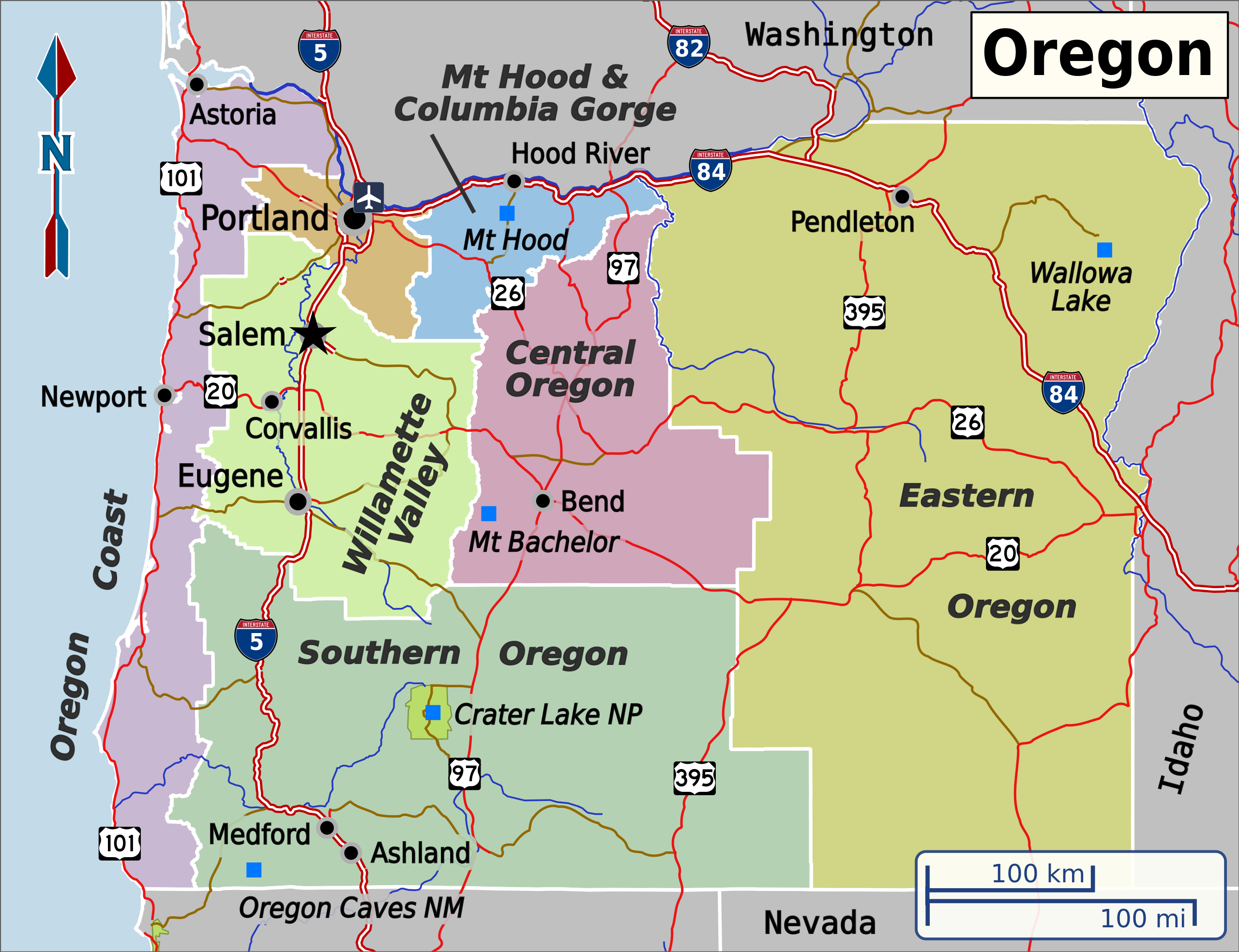
English: Base SVG for Wikivoyage regions map of Oregon. Map projection is Mercator (OSM). Red and white roads are Interstate highways, red roads are US highways and brown roads are state highways/other roads. |
| Date | |
| Source |
Own work, based on data from Natural Earth, OpenStreetMap and the Oregon Geospatial Enterprise Office. Highway shields were sourced from: |
| Author | Shaundd |
| Other versions |
|
Licensing
edit
I, the copyright holder of this work, hereby publish it under the following license:
This file is licensed under the Creative Commons Attribution-Share Alike 4.0 International license.
- You are free:
- to share – to copy, distribute and transmit the work
- to remix – to adapt the work
- Under the following conditions:
- attribution – You must give appropriate credit, provide a link to the license, and indicate if changes were made. You may do so in any reasonable manner, but not in any way that suggests the licensor endorses you or your use.
- share alike – If you remix, transform, or build upon the material, you must distribute your contributions under the same or compatible license as the original.
File history
Click on a date/time to view the file as it appeared at that time.
| Date/Time | Thumbnail | Dimensions | User | Comment | |
|---|---|---|---|---|---|
| current | 04:56, 6 September 2015 | | 889 × 683 (3.91 MB) | Shaundd (talk | contribs) | darken water and Oregon Coast region to improve contrast |
| 04:01, 25 August 2015 |  | 889 × 683 (3.91 MB) | Shaundd (talk | contribs) | User created page with UploadWizard |
You cannot overwrite this file.
File usage on Commons
There are no pages that use this file.
File usage on other wikis
The following other wikis use this file:
- Usage on is.wikipedia.org