File:Original New Candi Plan.png
Size of this preview: 457 × 600 pixels. Other resolutions: 183 × 240 pixels | 366 × 480 pixels | 775 × 1,017 pixels.
Original file (775 × 1,017 pixels, file size: 696 KB, MIME type: image/png)
Captions
Captions
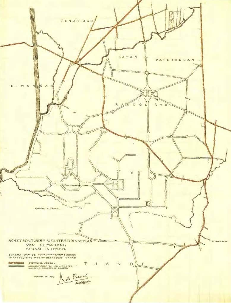
KPC de Bazel's 1907 plan for expanding Semarang
Summary edit
| Description |
English: A rough town plan for expanding Semarang south into the hills, present-day Candisari (Nieuw Tjandi), drawn by KPC de Bazel |
| Date | |
| Source | "Modern Indisch Town Planning", The Life & Work of Thomas Karsten. |
| Author | Anonymous |
Licensing edit
This work is in the public domain in the United States because it was published (or registered with the U.S. Copyright Office) before January 1, 1929.
Public domain works must be out of copyright in both the United States and in the source country of the work in order to be hosted on the Commons. If the work is not a U.S. work, the file must have an additional copyright tag indicating the copyright status in the source country.
Note: This tag should not be used for sound recordings. |
File history
Click on a date/time to view the file as it appeared at that time.
| Date/Time | Thumbnail | Dimensions | User | Comment | |
|---|---|---|---|---|---|
| current | 00:01, 7 May 2022 | | 775 × 1,017 (696 KB) | LlywelynII (talk | contribs) | Uploaded a work by Anonymous from "[https://www.academia.edu/34471083/Modern_lndisch_town_planning Modern Indisch Town Planning]", ''The Life & Work of Thomas Karsten''. with UploadWizard |
You cannot overwrite this file.
File usage on Commons
The following page uses this file:
File usage on other wikis
The following other wikis use this file:
- Usage on en.wikipedia.org