File:Orléanais.jpg

Size of this preview: 800 × 500 pixels. Other resolutions: 320 × 200 pixels | 640 × 400 pixels | 1,024 × 640 pixels | 1,280 × 800 pixels | 2,400 × 1,500 pixels.
Original file (2,400 × 1,500 pixels, file size: 1.77 MB, MIME type: image/jpeg)
Captions
Captions
France - Province of Orléanais
Summary edit
| Description |
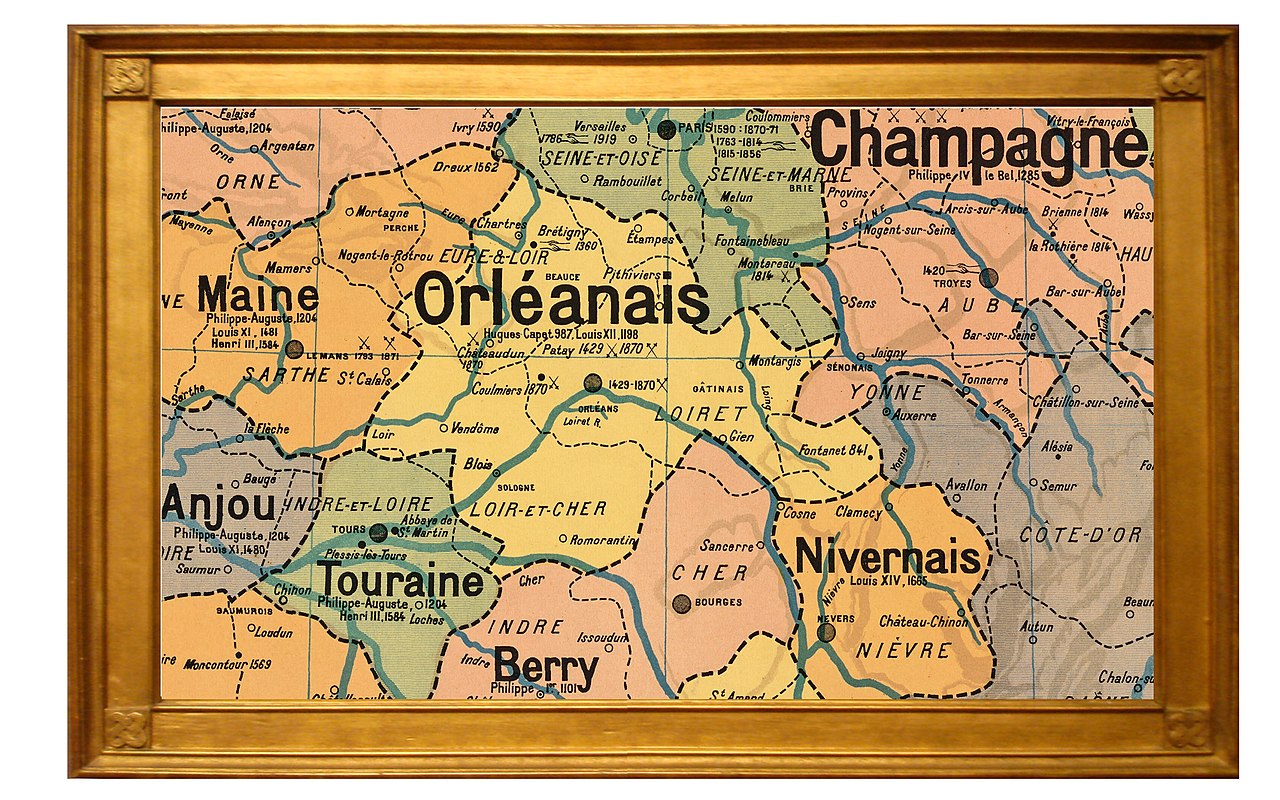
English: Map of the French province of Orléanais and adjacent provinces in 1789, showing relationship of pre-revolutionary province with departments of 1790.
Français : Carte de la province française de l'Orléanais en 1789 et les provinces adjacentes - montrant les relations entre la province pré-révolutionnaire et les départements de 1790. |
| Date | |
| Source | Own work |
| Author | Ty's Commons |
| Other versions |
Developed from a portion of public domain map entitled "France Provinces en 1789" par P. Vidal-Lablache (1845-1918) (Wikipedia: Paul Vidal de La Blache). Version of original large map of French provinces available on Wikimedia Commons at: File:Vidal-Lablache_n°9_-_Provinces_en_1789.jpg |
Licensing edit
I, the copyright holder of this work, hereby publish it under the following license:
This file is licensed under the Creative Commons Attribution-Share Alike 4.0 International license.
- You are free:
- to share – to copy, distribute and transmit the work
- to remix – to adapt the work
- Under the following conditions:
- attribution – You must give appropriate credit, provide a link to the license, and indicate if changes were made. You may do so in any reasonable manner, but not in any way that suggests the licensor endorses you or your use.
- share alike – If you remix, transform, or build upon the material, you must distribute your contributions under the same or compatible license as the original.
File history
Click on a date/time to view the file as it appeared at that time.
| Date/Time | Thumbnail | Dimensions | User | Comment | |
|---|---|---|---|---|---|
| current | 00:18, 20 January 2022 | | 2,400 × 1,500 (1.77 MB) | Ty's Commons (talk | contribs) | Uploaded own work with UploadWizard |
You cannot overwrite this file.
File usage on Commons
The following page uses this file:
File usage on other wikis
The following other wikis use this file:
- Usage on en.wikipedia.org