File:Orodistricts.svg

Size of this PNG preview of this SVG file: 709 × 600 pixels. Other resolutions: 284 × 240 pixels | 568 × 480 pixels | 908 × 768 pixels | 1,211 × 1,024 pixels | 2,422 × 2,048 pixels | 1,433 × 1,212 pixels.
Original file (SVG file, nominally 1,433 × 1,212 pixels, file size: 45 KB)
Captions
Captions
Add a one-line explanation of what this file represents
Summary edit
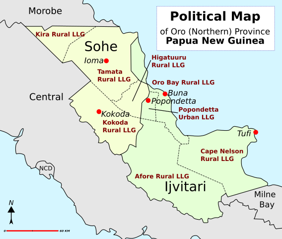
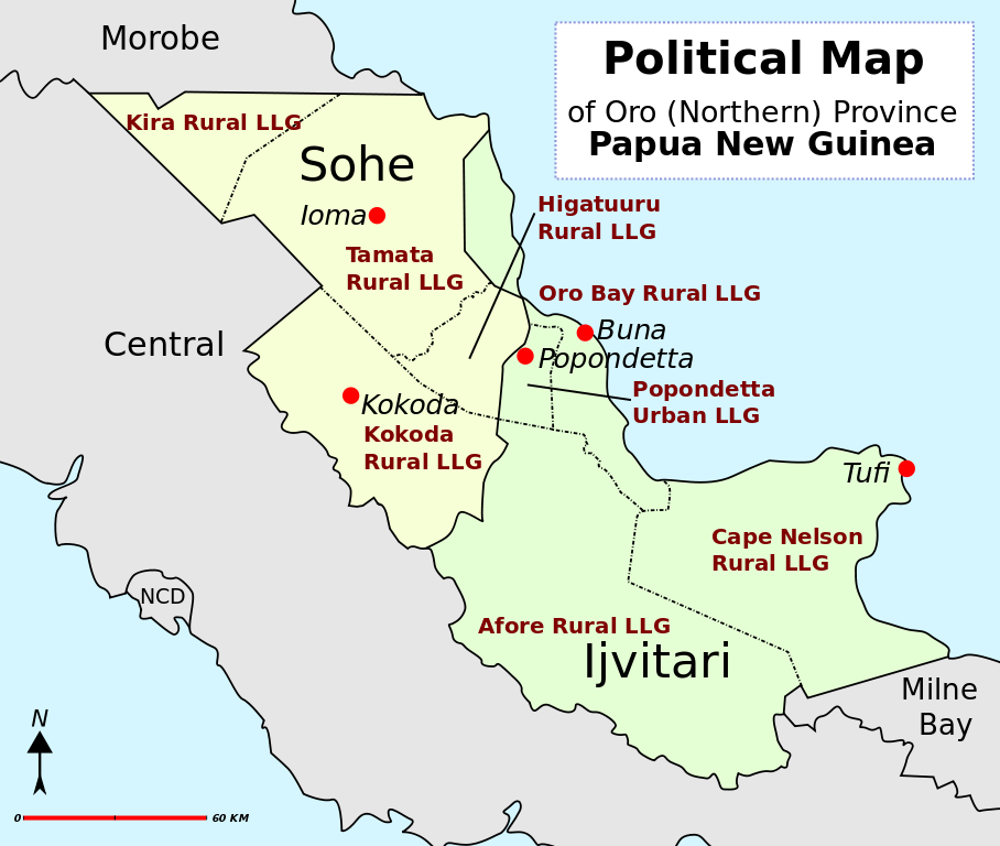
| Description | District map of Oro (Northern) Province, Papua New Guinea |
| Date | |
| Source | Own work |
| Author | Alaisd |
Licensing edit
| This work has been released into the public domain by its author, Alaisd. This applies worldwide. In some countries this may not be legally possible; if so: Alaisd grants anyone the right to use this work for any purpose, without any conditions, unless such conditions are required by law. |
File history
Click on a date/time to view the file as it appeared at that time.
| Date/Time | Thumbnail | Dimensions | User | Comment | |
|---|---|---|---|---|---|
| current | 07:54, 12 July 2007 | | 1,433 × 1,212 (45 KB) | Aliasd (talk | contribs) | |
| 10:37, 7 July 2007 |  | 506 × 428 (23 KB) | Aliasd (talk | contribs) | {{Information |Description=District map of Papua New Guinea |Source=self-made |Date=2007 |Author= Alaisd }} {{PD-Self}} | |
| 10:33, 7 July 2007 |  | 506 × 428 (23 KB) | Aliasd (talk | contribs) | {{Information |Description=District map of Papua New Guinea |Source=self-made |Date=2007 |Author= Alaisd }} {{PD-Self}} | |
| 10:26, 7 July 2007 |  | 506 × 428 (23 KB) | Aliasd (talk | contribs) | {{Information |Description=District map of Papua New Guinea |Source=self-made |Date=2007 |Author= Alaisd }} {{PD-Self}} |
You cannot overwrite this file.
File usage on Commons
There are no pages that use this file.
File usage on other wikis
The following other wikis use this file:
- Usage on als.wikipedia.org
- Usage on de.wikipedia.org
- Usage on en.wikipedia.org
- Usage on fa.wikipedia.org
- Usage on fi.wikipedia.org
- Usage on fr.wikipedia.org
- Usage on id.wikipedia.org
- Usage on it.wikipedia.org
- Usage on ka.wikipedia.org
- Usage on la.wikipedia.org
- Usage on pl.wikipedia.org
- Usage on ru.wikipedia.org
- Usage on tpi.wikipedia.org
- Usage on uk.wikipedia.org
- Usage on zh.wikipedia.org