File:Osm-railway-karintorf-whole-z12-mapnik-e.png
Size of this preview: 522 × 600 pixels. Other resolutions: 209 × 240 pixels | 418 × 480 pixels | 668 × 768 pixels | 891 × 1,024 pixels | 1,782 × 2,048 pixels | 3,113 × 3,577 pixels.
Original file (3,113 × 3,577 pixels, file size: 2.79 MB, MIME type: image/png)
Captions
Captions
Add a one-line explanation of what this file represents
| Description |
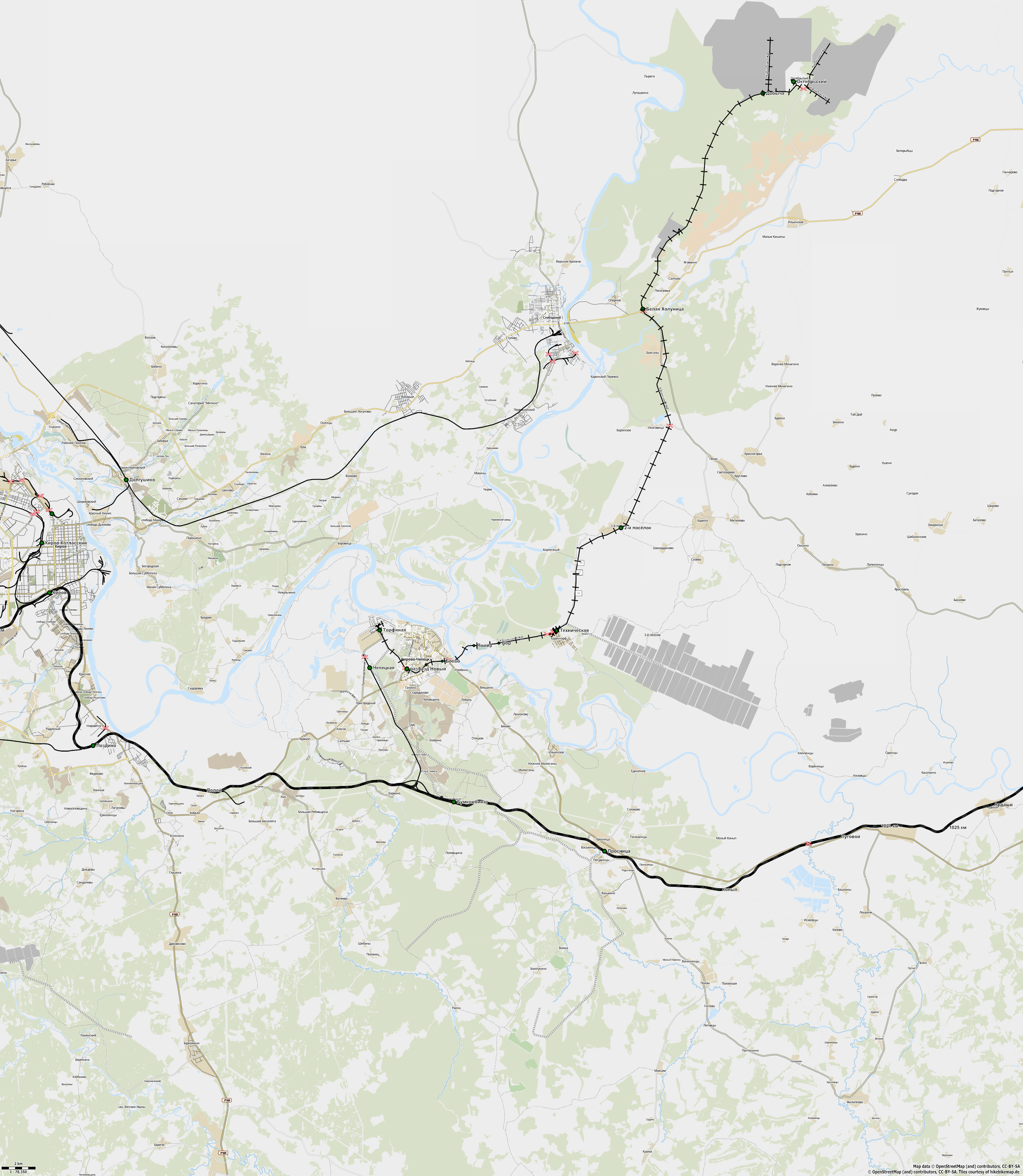
English: Map of Karintorf narrow gauge railway. 2011.
Русский: Карта Каринской УЖД на 2011 год. Основные линии.
|
| Date | |
| Source | http://openstreetmap.org |
| Creator |
OpenStreetMap contribtors |
| Permission (Reusing this file) |
This file is licensed under the Creative Commons Attribution-Share Alike 2.0 Generic license.
|
| Georeferencing | If inappropriate please set warp_status = skip to hide. |
}}
File history
Click on a date/time to view the file as it appeared at that time.
| Date/Time | Thumbnail | Dimensions | User | Comment | |
|---|---|---|---|---|---|
| current | 11:27, 28 April 2012 | | 3,113 × 3,577 (2.79 MB) | Svetlov Artem (talk | contribs) | Уточнения по результатам поездки |
| 13:31, 17 December 2011 |  | 3,113 × 3,577 (3.44 MB) | Svetlov Artem (talk | contribs) | {{Information |Description ={{en|1=Map of Karintorf narrow gauge railway. 2011. }} {{ru|1=Карта Каринской УЖД на 2011 год. Основные линии. : bounds-set 49.6005830405415,58.2592980163196,50.6695255596039,58.89948856098 |
You cannot overwrite this file.
File usage on Commons
There are no pages that use this file.
File usage on other wikis
The following other wikis use this file:
- Usage on de.wikipedia.org