File:Ost-See, XVII.jpg

Size of this preview: 672 × 600 pixels. Other resolutions: 269 × 240 pixels | 538 × 480 pixels | 896 × 800 pixels.
Original file (896 × 800 pixels, file size: 302 KB, MIME type: image/jpeg)
Captions
Captions
Add a one-line explanation of what this file represents
Summary
edit
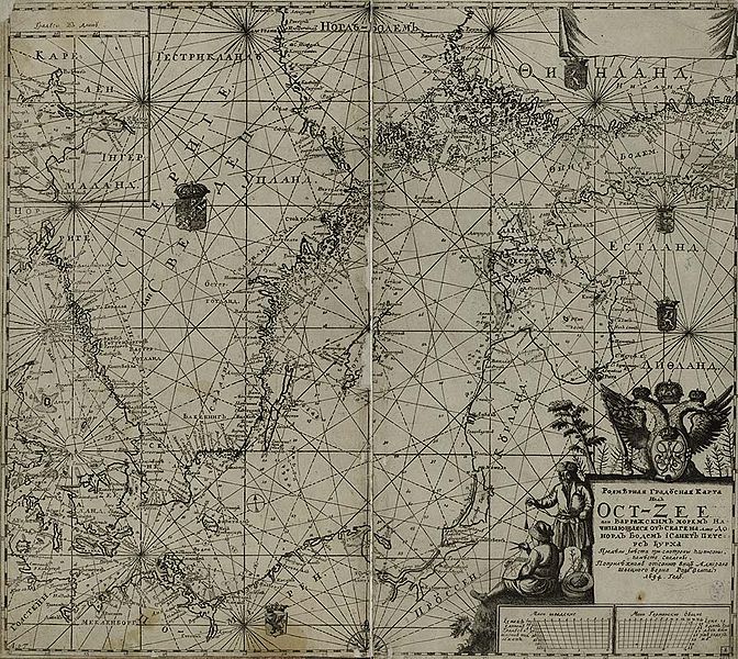
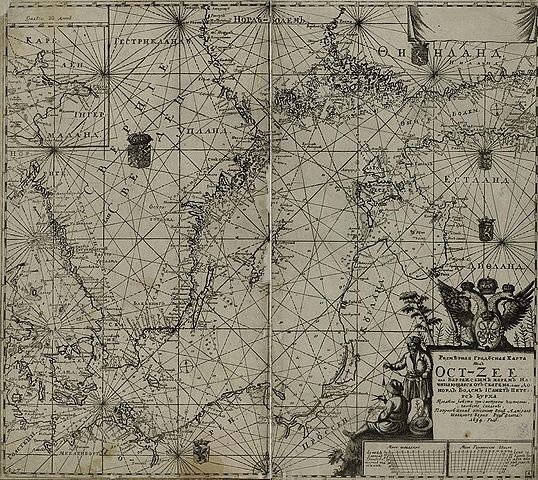
| Description |
Eesti: Läänemeremaade kaart
Русский: Карта восточной части Балтийского моря |
| Date | |
| Source | Книга розмерная градусных Ост-Зее или Варяжского моря. Санкт-Петербург, 1719. / РНБ / [1] |
| Author | Unknown author |
![[1]](http://expositions.nlr.ru/holland/images/varjag.jpg)
Licensing
edit
|
This work is in the public domain in its country of origin and other countries and areas where the copyright term is the author's life plus 100 years or fewer. | |
| This file has been identified as being free of known restrictions under copyright law, including all related and neighboring rights. | |
Original upload log
edit
The original description page was here. All following user names refer to et.wikipedia.
| Date/Time | Dimensions | User | Comment |
|---|---|---|---|
| 07:32, 2 June 2011 | 896 × 800 (308860 B) | NOSSER | [[Läänemeremaad]]e kaart, [[1694]]. aastast |
File history
Click on a date/time to view the file as it appeared at that time.
| Date/Time | Thumbnail | Dimensions | User | Comment | |
|---|---|---|---|---|---|
| current | 14:28, 5 November 2014 | | 896 × 800 (302 KB) | Pikne (talk | contribs) | Transferred from et.wikipedia: see original upload log above |
You cannot overwrite this file.
File usage on Commons
There are no pages that use this file.
File usage on other wikis
The following other wikis use this file:
- Usage on et.wikipedia.org