File:Ostseebad Rerik am Salzhaff (50671904537).jpg

Size of this preview: 800 × 533 pixels. Other resolutions: 320 × 213 pixels | 640 × 426 pixels | 1,024 × 682 pixels | 1,280 × 853 pixels | 3,000 × 1,999 pixels.
Original file (3,000 × 1,999 pixels, file size: 5.69 MB, MIME type: image/jpeg)
Captions
Captions
Add a one-line explanation of what this file represents
Summary edit
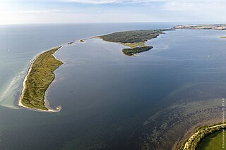
| Description | Nehrung, Sandhaken, Wustrow, Salzwiesen | |||||||||||
| Date | ||||||||||||
| Source | Ostseebad Rerik am Salzhaff | |||||||||||
| Author |
|
|||||||||||

.jpg&action=edit§ion=1)
| Camera location | | View this and other nearby images on: OpenStreetMap |
|---|
.jpg¶ms=054.028997_N_0011.515900_E_globe:Earth_type:camera_source:Flickr_&language=en)
Licensing edit
.jpg&action=edit§ion=2)
This file is licensed under the Creative Commons Attribution 2.0 Generic license.
- You are free:
- to share – to copy, distribute and transmit the work
- to remix – to adapt the work
- Under the following conditions:
- attribution – You must give appropriate credit, provide a link to the license, and indicate if changes were made. You may do so in any reasonable manner, but not in any way that suggests the licensor endorses you or your use.
| This image was originally posted to Flickr by BAW_Bundesanstalt für Wasserbau at https://flickr.com/photos/64906758@N07/50671904537. It was reviewed on 4 February 2021 by FlickreviewR 2 and was confirmed to be licensed under the terms of the cc-by-2.0. |
File history
Click on a date/time to view the file as it appeared at that time.
| Date/Time | Thumbnail | Dimensions | User | Comment | |
|---|---|---|---|---|---|
| current | 23:34, 4 February 2021 | | 3,000 × 1,999 (5.69 MB) | Tm (talk | contribs) | Transferred from Flickr via #flickr2commons |
You cannot overwrite this file.
File usage on Commons
The following page uses this file:
File usage on other wikis
The following other wikis use this file:
.jpg&oldid=697935176)