File:Oud postkantoor, Koning Albert I-plein 34, Leopoldsburg.jpg
Size of this preview: 800 × 600 pixels. Other resolutions: 320 × 240 pixels | 640 × 480 pixels | 1,024 × 768 pixels | 1,280 × 960 pixels | 2,592 × 1,944 pixels.
Original file (2,592 × 1,944 pixels, file size: 1.9 MB, MIME type: image/jpeg)
File information
Structured data
Captions
Summary edit
DescriptionOud postkantoor, Koning Albert I-plein 34, Leopoldsburg.jpg |
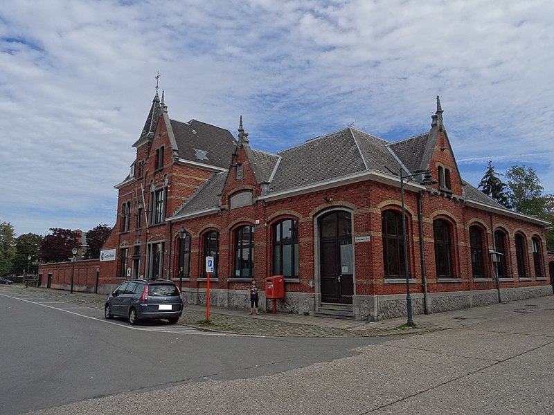
Français : Ancien bureau de poste.
English: Old postoffice.
|
|||||
Date | ||||||
Source | Own work | |||||
Author | Phil M~wiki |
Camera location | 51° 06′ 55.2″ N, 5° 15′ 49.2″ E | View this and other nearby images on: OpenStreetMap | 51.115333; 5.263667 |
---|
Licensing edit
I, the copyright holder of this work, hereby publish it under the following license:
This file is licensed under the Creative Commons Attribution 4.0 International license.
- You are free:
- to share – to copy, distribute and transmit the work
- to remix – to adapt the work
- Under the following conditions:
- attribution – You must give appropriate credit, provide a link to the license, and indicate if changes were made. You may do so in any reasonable manner, but not in any way that suggests the licensor endorses you or your use.
This image was uploaded as part of the photo contest Wiki Loves Heritage in Belgium in 2018 in the European Year of Cultural Heritage.
Deutsch | English | français | Nederlands | +/− |
File history
Click on a date/time to view the file as it appeared at that time.
Date/Time | Thumbnail | Dimensions | User | Comment | |
---|---|---|---|---|---|
current | 10:38, 11 September 2018 | 2,592 × 1,944 (1.9 MB) | Phil M~wiki (talk | contribs) | User created page with UploadWizard |
You cannot overwrite this file.
File usage on Commons
There are no pages that use this file.
Metadata
This file contains additional information such as Exif metadata which may have been added by the digital camera, scanner, or software program used to create or digitize it. If the file has been modified from its original state, some details such as the timestamp may not fully reflect those of the original file. The timestamp is only as accurate as the clock in the camera, and it may be completely wrong.
Camera manufacturer | SONY |
---|---|
Camera model | DSC-HX50V |
Exposure time | 1/400 sec (0.0025) |
F-number | f/4.5 |
ISO speed rating | 80 |
Date and time of data generation | 12:28, 9 September 2018 |
Lens focal length | 4.3 mm |
Latitude | 51° 6′ 55.2″ N |
Longitude | 5° 15′ 49.2″ E |
Altitude | 38.3 meters above sea level |
Orientation | Normal |
Horizontal resolution | 350 dpi |
Vertical resolution | 350 dpi |
Software used | DSC-HX50V v1.00 |
File change date and time | 12:28, 9 September 2018 |
Exposure Program | Normal program |
Exif version | 2.3 |
Date and time of digitizing | 12:28, 9 September 2018 |
Image compression mode | 3 |
APEX brightness | 9.8648431214803 |
APEX exposure bias | 0 |
Maximum land aperture | 3.6171875 APEX (f/3.5) |
Metering mode | Pattern |
Light source | Unknown |
Flash | Flash did not fire, compulsory flash suppression |
Supported Flashpix version | 1 |
Color space | sRGB |
Custom image processing | Normal process |
Exposure mode | Auto exposure |
White balance | Auto white balance |
Digital zoom ratio | 1 |
Scene capture type | Standard |
Contrast | Normal |
Saturation | Normal |
Sharpness | Normal |
GPS time (atomic clock) | 10:28 |
Receiver status | Measurement in progress |
Measurement mode | 3-dimensional measurement |
Measurement precision | Poor (1.32) |
Speed unit | Kilometers per hour |
Speed of GPS receiver | 5.22 |
Reference for direction of movement | True direction |
Direction of movement | 58.65 |
Geodetic survey data used | WGS-84 |
GPS date | 9 September 2018 |
GPS differential correction | 0 |
GPS tag version | 2.3.0.0 |