File:Outline Map of Kurgan Oblast 2014.svg

Size of this PNG preview of this SVG file: 512 × 377 pixels. Other resolutions: 320 × 236 pixels | 640 × 471 pixels | 1,024 × 754 pixels | 1,280 × 943 pixels | 2,560 × 1,885 pixels.
Original file (SVG file, nominally 512 × 377 pixels, file size: 196 KB)
Captions
Captions
Add a one-line explanation of what this file represents
Summary
edit| Description |
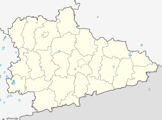
Русский: Позиционная карта Курганской области
|top    = 57.0
|bottom = 54.0
|left   = 61.7
|right  = 68.9
В этой версии файла обновлены границы городов Курган и Шадринск. |
| Date | |
| Source |
Own work This W3C-unspecified vector image was created with Inkscape . |
| Author | Виктор В, Nzeemin, OpenStreetMap contributors |
| Other versions |
|

Licensing
edit
This file is licensed under the Creative Commons Attribution-Share Alike 2.0 Generic license.
- You are free:
- to share – to copy, distribute and transmit the work
- to remix – to adapt the work
- Under the following conditions:
- attribution – You must give appropriate credit, provide a link to the license, and indicate if changes were made. You may do so in any reasonable manner, but not in any way that suggests the licensor endorses you or your use.
- share alike – If you remix, transform, or build upon the material, you must distribute your contributions under the same or compatible license as the original.
File history
Click on a date/time to view the file as it appeared at that time.
| Date/Time | Thumbnail | Dimensions | User | Comment | |
|---|---|---|---|---|---|
| current | 18:51, 2 March 2014 | | 512 × 377 (196 KB) | Nzeemin (talk | contribs) | fix for layers z-order |
| 18:44, 2 March 2014 |  | 512 × 377 (195 KB) | Nzeemin (talk | contribs) | User created page with UploadWizard |
You cannot overwrite this file.
File usage on Commons
The following 3 pages use this file:
File usage on other wikis
The following other wikis use this file:
- Usage on af.wikipedia.org
- Usage on ba.wikipedia.org
- Тәңрекүл
- Асҡар (Ҡурған өлкәһе)
- Юламан (Ҡурған өлкәһе)
- Арыҫлан (Ҡурған өлкәһе)
- Атйетәр (Ҡурған өлкәһе)
- Абултай
- Аҙналы (Ҡурған өлкәһе)
- Кесе Солтан
- Оло Солтан
- Ҡамышлы (Сафакүл районы)
- Надеждинка (Ҡурған өлкәһе)
- Озерная (Ҡурған өлкәһе)
- Белое Озеро (Ҡурған өлкәһе)
- Субботино (Ҡурған өлкәһе)
- Бугуй
- Мырҙабай
- Бикбирҙе
- Баҡай (Ҡурған өлкәһе)
- Һарт-Әбдрәш
- Баязит (Ҡурған өлкәһе)
- Ҡалмаҡ-Әбдрәш
- Сафакүл
- Мансур (Ҡурған өлкәһе)
- Һөлөклө
- Бормат
- Максимовка (Ҡурған өлкәһе)
- Ялан (Ҡурған өлкәһе)
- Сокольники (Ҡурған өлкәһе)
- Петровка (Сафакүл районы)
- Сөләймән (Ҡурған өлкәһе)
- Шәрип (Ҡурған өлкәһе)
- Байғана
- Поляна (Ҡурған өлкәһе)
- Щучанка
- Майлыҡ
- Озерное (Әлмән районы)
- Бохара (Ҡурған өлкәһе)
- Искәндәр (Ҡурған өлкәһе)
- Ҡаҙаҡҡол (Ҡурған өлкәһе)
- Подъясово
- Киләй-Ҡаҙаҡҡол
- Зәйнәкәй
- Әлмән (Ҡурған өлкәһе)
- Ҡурған (ҡала)
- Парамоново (Ҡурған өлкәһе)
- Ҡыҙылбай
- Юлдус
- Себеркә
View more global usage of this file.