File:Outline Map of Sortavalsky District (Karelia).svg

Size of this PNG preview of this SVG file: 187 × 316 pixels. Other resolutions: 142 × 240 pixels | 284 × 480 pixels | 454 × 768 pixels | 606 × 1,024 pixels | 1,212 × 2,048 pixels.
Original file (SVG file, nominally 187 × 316 pixels, file size: 31 KB)
Captions
Captions
Add a one-line explanation of what this file represents
Summary
edit.svg&action=edit§ion=1)
| Description |
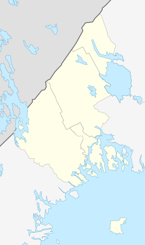
Русский: Позиционная карта Сортавальского района Республики Карелия Равноугольная проекция, растяжение — 220%. Координаты краёв:
|
| Date | |
| Source |
Own work This W3C-unspecified vector image was created with Inkscape . |
| Author | Виктор В |
Licensing
edit.svg&action=edit§ion=2)
| I, the copyright holder of this work, release this work into the public domain. This applies worldwide. In some countries this may not be legally possible; if so: I grant anyone the right to use this work for any purpose, without any conditions, unless such conditions are required by law. |
File history
Click on a date/time to view the file as it appeared at that time.
| Date/Time | Thumbnail | Dimensions | User | Comment | |
|---|---|---|---|---|---|
| current | 15:40, 19 May 2021 | | 187 × 316 (31 KB) | RosssW (talk | contribs) | 2020 |
| 09:56, 20 March 2010 |  | 187 × 316 (31 KB) | Виктор В (talk | contribs) | == {{int:filedesc}} == {{Information |Description={{ru|1=Позиционная карта Сортавальского района Республики Карелия<br>Равноугольная проекция, растяжение — 220%. Коо� |
You cannot overwrite this file.
File usage on Commons
There are no pages that use this file.
File usage on other wikis
The following other wikis use this file:
- Usage on fi.wikipedia.org
- Usage on fr.wikipedia.org
- Usage on olo.wikipedia.org
- Usage on os.wikipedia.org
- Usage on ru.wikipedia.org
- Сортавала
- Хелюля
- Сортавальский район
- Вяртсиля
- Контиолахти (Карелия)
- Алалампи
- Пирттипохья
- Маткаселькя
- Кааламо
- Рюттю
- Куокканиэми
- Туокслахти
- Янисйоки
- Тохмайоки
- Хаапалампи
- Заозёрный (Карелия)
- Лавиярви (посёлок)
- Куоккаярви
- Пюхяярви (озеро на российско-финляндской границе)
- Вахваярви
- Рускеала (Сортавальский район)
- Ханхипаси
- Оборонный
- Дивный (остров)
- Шаблон:ПозКарта Россия Карелия Сортавальский район
- Каранкооя
- Китенйоки
- Леппяоя
- Савайнйоки
- Сахийоки
- Хейноя
- Юуванйоки
- Валаам (посёлок)
- Святой (остров)
- Хюмпёля
- Токкарлахти
- Рантуэ
- Оявойс
View more global usage of this file.
.svg)
.svg&oldid=561820893)