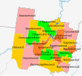
File:Outline Map of Velikoustyugsky District (Vologda Oblast).svg

Size of this PNG preview of this SVG file: 171 × 157 pixels. Other resolutions: 261 × 240 pixels | 523 × 480 pixels | 837 × 768 pixels | 1,115 × 1,024 pixels | 2,231 × 2,048 pixels.
Original file (SVG file, nominally 171 × 157 pixels, file size: 194 KB)
File information
Structured data
Captions
Captions
Add a one-line explanation of what this file represents
Summary
edit| DescriptionOutline Map of Velikoustyugsky District (Vologda Oblast).svg |
Русский: Сельские и городские поселения Великоустюгского муниципального района с 2017 года |
| Date | |
| Source | Own work |
| Author | RosssW |
Licensing
editI, the copyright holder of this work, hereby publish it under the following license:
This file is licensed under the Creative Commons Attribution-Share Alike 4.0 International license.
- You are free:
- to share – to copy, distribute and transmit the work
- to remix – to adapt the work
- Under the following conditions:
- attribution – You must give appropriate credit, provide a link to the license, and indicate if changes were made. You may do so in any reasonable manner, but not in any way that suggests the licensor endorses you or your use.
- share alike – If you remix, transform, or build upon the material, you must distribute your contributions under the same or compatible license as the original.
File history
Click on a date/time to view the file as it appeared at that time.
| Date/Time | Thumbnail | Dimensions | User | Comment | |
|---|---|---|---|---|---|
| current | 16:33, 6 September 2021 |  | 171 × 157 (194 KB) | RosssW (talk | contribs) | корр |
| 15:55, 6 September 2021 |  | 171 × 157 (179 KB) | RosssW (talk | contribs) | корр | |
| 15:45, 6 September 2021 |  | 171 × 157 (130 KB) | RosssW (talk | contribs) | Uploaded own work with UploadWizard |
You cannot overwrite this file.
File usage on Commons
There are no pages that use this file.
File usage on other wikis
The following other wikis use this file:
- Usage on ru.wikipedia.org
- Великий Устюг
- Красавино
- Кузино (Великоустюгский район)
- Дымково (Вологодская область)
- Шаблон:ПозКарта Россия Вологодская область Великоустюгский район
- Лименда
- Верхняя Ёрга
- Лапинка
- Стрига (река)
- Ухтомка
- Ямжа
- Андроново (Великоустюгский район)
- Антушево (Великоустюгский район)
- Большое Ворошнино
- Верхнее Чистяково
- Макарово (Великоустюгский район)
- Малиново (Великоустюгский район)
- Марилово (Вологодская область)
- Минино (Великоустюгский район)
- Митихино
- Мякинницыно
- Насоново (Верхневарженский сельсовет)
- Нижнее Займище
- Нижнее Чистяково
- Пасная
- Соболево (Великоустюгский район)
- Старина (Великоустюгский район)
- Стрюково (Вологодская область)
- Удачино (Вологодская область)
- Антипово (Вологодская область)
- Бакшеево (Вологодская область)
- Верхняя Шарденьга
- Выставка (Вологодская область)
- Гора (Великоустюгский район)
- Горбачево (Вологодская область)
- Жуково (Великоустюгский район)
- Загорье (Верхнешарденгский сельсовет)
- Истопная (Вологодская область)
- Касьянка
- Липовец 1-й
- Липовка (Вологодская область)
- Москвин Починок
- Мурдинская
- Орлов Починок
- Осница (Вологодская область)
- Подвалье (Вологодская область)
- Подволочье (Верхнешарденгский сельсовет)
- Ребцово
- Слободчиково (Вологодская область)
- Старый Починок (Вологодская область)
View more global usage of this file.
Metadata
This file contains additional information such as Exif metadata which may have been added by the digital camera, scanner, or software program used to create or digitize it. If the file has been modified from its original state, some details such as the timestamp may not fully reflect those of the original file. The timestamp is only as accurate as the clock in the camera, and it may be completely wrong.
| Width | 171.32001 |
|---|---|
| Height | 157.05 |