File:Outline Map of Velikoustyugsky District (Vologda Oblast, 2009).svg

Size of this PNG preview of this SVG file: 171 × 157 pixels. Other resolutions: 261 × 240 pixels | 523 × 480 pixels | 837 × 768 pixels | 1,115 × 1,024 pixels | 2,231 × 2,048 pixels.
Original file (SVG file, nominally 171 × 157 pixels, file size: 44 KB)
Captions
Captions
Add a one-line explanation of what this file represents
Summary
edit| Description |
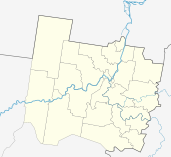
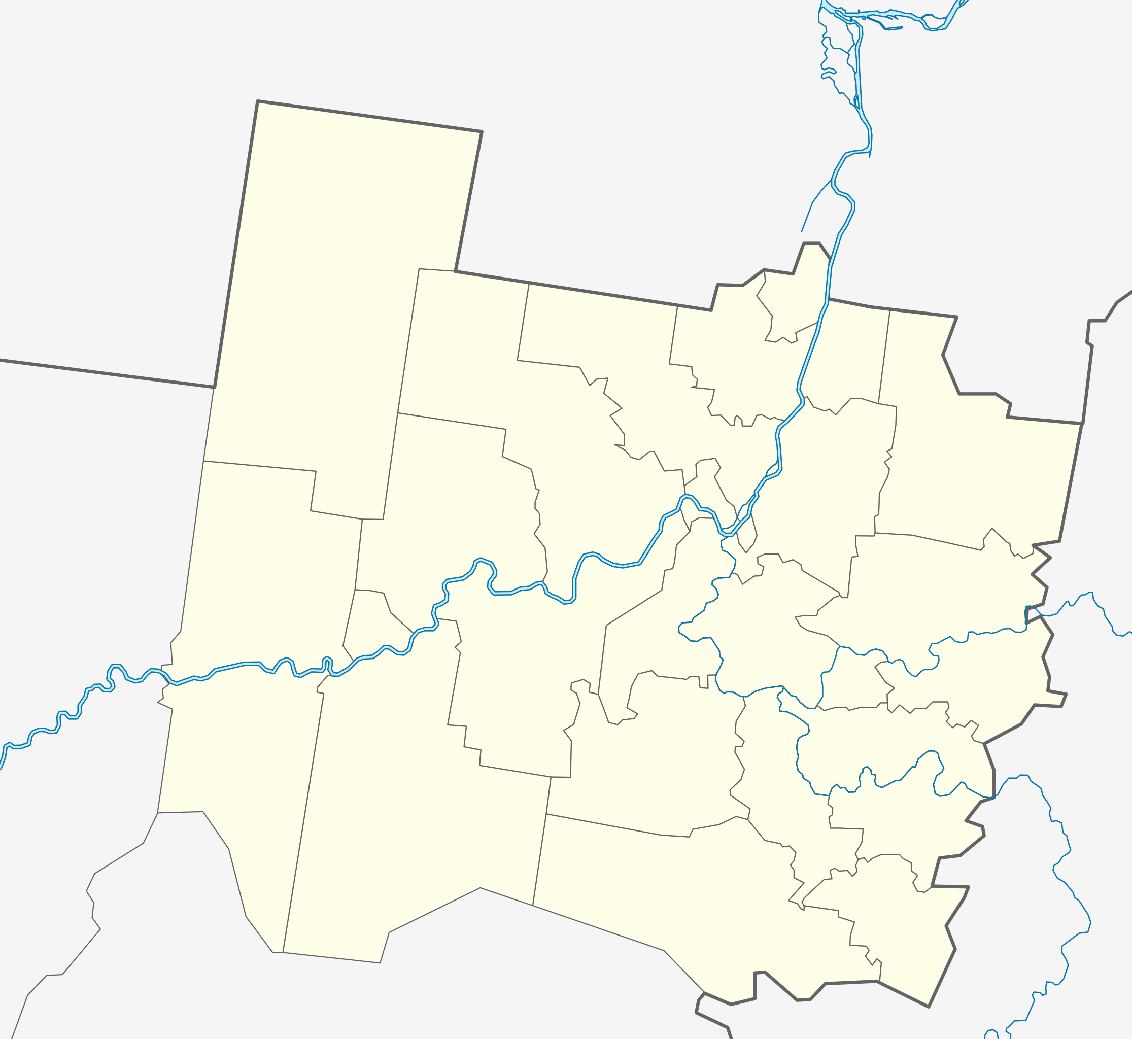
Русский: Позиционная карта Великоустюгского района Вологодской области, 2009 год Равноугольная проекция, растяжение — 200 %. Координаты краёв:
|
| Date | |
| Source |
|
| Author | Виктор В |
| Other versions |
[]
|
.svg)
.svg)
.svg&action=edit§ion=1)
Licensing
edit.svg&action=edit§ion=2)
| I, the copyright holder of this work, release this work into the public domain. This applies worldwide. In some countries this may not be legally possible; if so: I grant anyone the right to use this work for any purpose, without any conditions, unless such conditions are required by law. |
File history
Click on a date/time to view the file as it appeared at that time.
| Date/Time | Thumbnail | Dimensions | User | Comment | |
|---|---|---|---|---|---|
| current | 14:05, 10 August 2010 | | 171 × 157 (44 KB) | Виктор В (talk | contribs) | == {{int:filedesc}} == {{Information |Description={{ru|1=Позиционная карта Великоустюгского района Вологодской области, 2009 год<br>Равноугольная проекция, растяжени� |
You cannot overwrite this file.
File usage on Commons
The following 3 pages use this file:
File usage on other wikis
The following other wikis use this file:
- Usage on fi.wikipedia.org
.svg&oldid=456218574)