File:Outline Map of Voronezh Oblast (with position on the map of Russia).svg

Size of this PNG preview of this SVG file: 722 × 600 pixels. Other resolutions: 289 × 240 pixels | 578 × 480 pixels | 925 × 768 pixels | 1,233 × 1,024 pixels | 2,466 × 2,048 pixels | 1,983 × 1,647 pixels.
Original file (SVG file, nominally 1,983 × 1,647 pixels, file size: 362 KB)
Captions
Captions
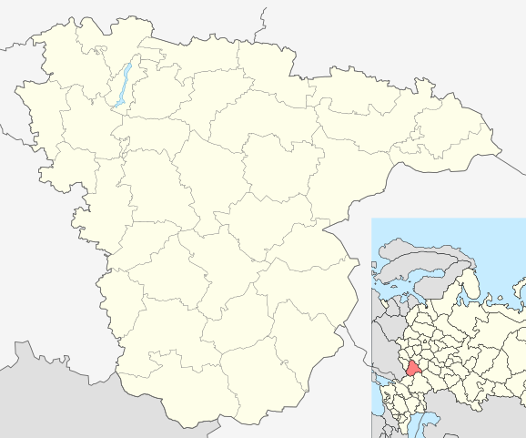
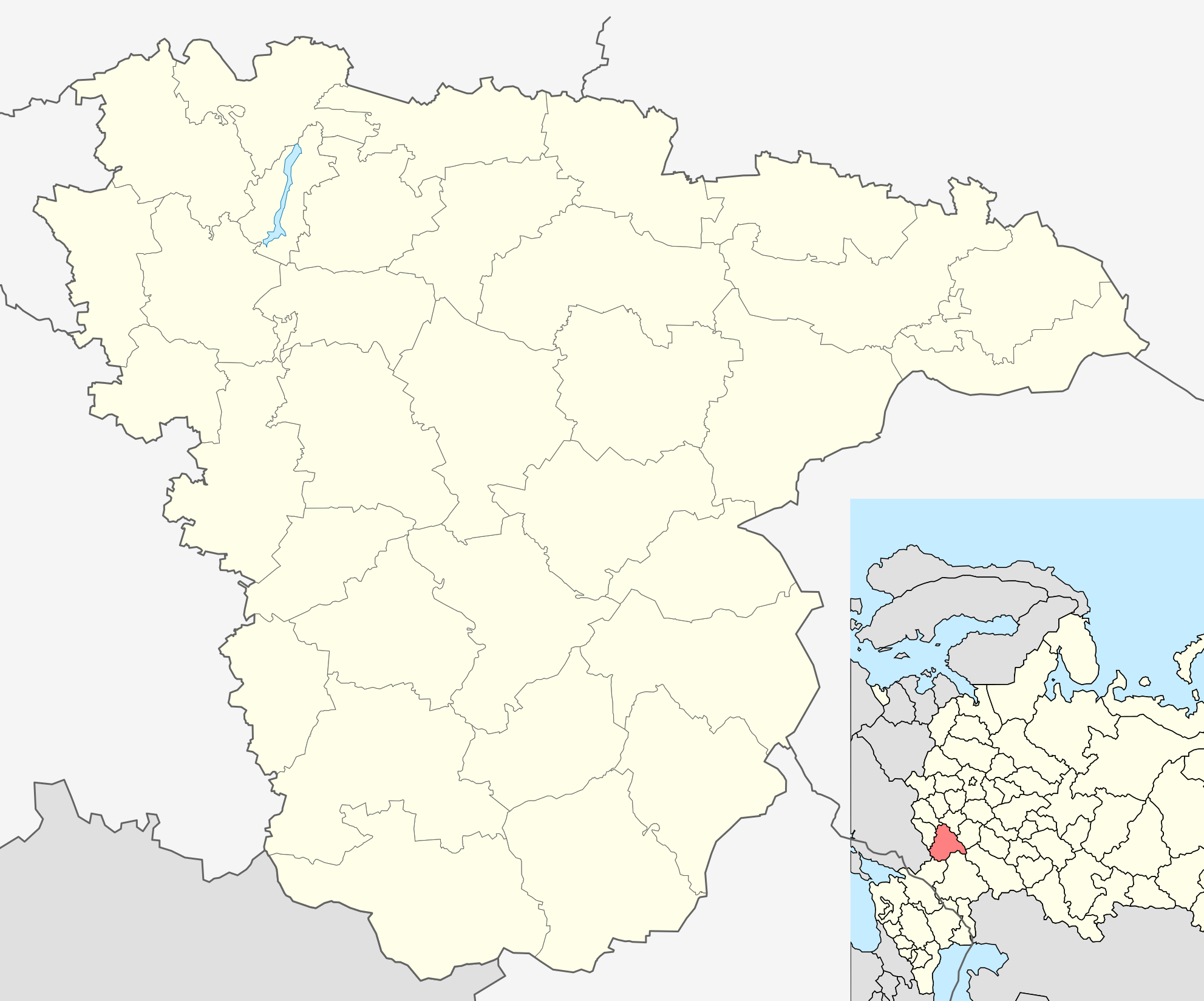
Voronezh Oblast within the Russian Federation
| Description |
Русский: Позиционная карта Воронежской области Равноугольная проекция, растяжение - 160%. Координаты краёв:
|
| Date | (UTC) |
| Source | |
| Author | |
| Other versions |
[]
|


.svg)
.svg)
| This is a retouched picture, which means that it has been digitally altered from its original version. The original can be viewed here: Outline Map of Voronezh Oblast.svg:
|
This file is licensed under the Creative Commons Attribution-Share Alike 3.0 Unported license.
- You are free:
- to share – to copy, distribute and transmit the work
- to remix – to adapt the work
- Under the following conditions:
- attribution – You must give appropriate credit, provide a link to the license, and indicate if changes were made. You may do so in any reasonable manner, but not in any way that suggests the licensor endorses you or your use.
- share alike – If you remix, transform, or build upon the material, you must distribute your contributions under the same or compatible license as the original.
Original upload log
edit.svg&action=edit§ion=1)
This image is a derivative work of the following images:
- File:Map_of_Russia_-_Voronezh_Oblast_(2008-03).svg licensed with Cc-by-sa-2.5
- 2010-02-04T17:38:49Z Виктор В 1092x630 (213460 Bytes) new color
- 2008-01-27T18:23:35Z Marmelad 1092x630 (227715 Bytes) {{Information |Description=Autogenerated image to indicate Russian subjects as of 2008-03. Subject as indicated by filename. |Source=Made from [[:Image:Map of Russian subjects, 2008-03-01.svg]] |Date=2008-01-27 |Author=[[User
- File:Outline_Map_of_Voronezh_Oblast.svg licensed with PD-self
- 2010-02-21T09:38:33Z Виктор В 1983x1647 (158607 Bytes) == {{int:filedesc}} == {{Information |Description={{ru|1=Позиционная карта Воронежской областиРавноугольная проекция, растяжение - 160%. Координаты к
Uploaded with derivativeFX
File history
Click on a date/time to view the file as it appeared at that time.
| Date/Time | Thumbnail | Dimensions | User | Comment | |
|---|---|---|---|---|---|
| current | 10:26, 21 February 2010 | | 1,983 × 1,647 (362 KB) | Виктор В (talk | contribs) | {{Information |Description={{ru|1=Позиционная карта Воронежской области<br>Равноугольная проекция, растяжение - 160%. Координаты краёв: * север - 52.2° С * юг - 49.5� |
You cannot overwrite this file.
File usage on Commons
The following 4 pages use this file:
File usage on other wikis
The following other wikis use this file:
- Usage on af.wikipedia.org
- Usage on ar.wikipedia.org
- Usage on azb.wikipedia.org
- Usage on ceb.wikipedia.org
- Usage on en.wikipedia.org
- Voronezh
- Novovoronezh
- Semiluki
- Borisoglebsk
- Rossosh, Rossoshansky District, Voronezh Oblast
- Liski, Voronezh Oblast
- Povorino
- Boguchar
- Novokhopyorsk
- Ostrogozhsk
- Voronezh International Airport
- Pavlovsk, Voronezh Oblast
- Ertil, Voronezh Oblast
- Voronezh Malshevo (air base)
- Borisoglebsk (air base)
- Buturlinovka (air base)
- Ramon, Russia
- Bobrov, Bobrovsky District, Voronezh Oblast
- Kalach, Kalacheyevsky District, Voronezh Oblast
- Module:Location map/data/Russia Voronezh Oblast/doc
- Buturlinovka
- Maklok, Voronezh Oblast
- Makarye, Voronezh Oblast
- Nechayevka, Voronezh Oblast
- 2014 Winter Olympics torch relay
- Kostyonki, Voronezh Oblast
- Module:Location map/data/Russia Voronezh Oblast
- 1st otdeleniya sovkhoza 'Maslovskiy'
- 1st otdeleniya sovkhoza 'Novousmanskiy'
- 2nd Nikolskoye
- 40 let Oktyabrya
- Abramovka, Verkhnekhavsky District, Voronezh Oblast
- Abramovka, Abramovskoye Rural Settlement, Talovsky District, Voronezh Oblast
- Abrosimovo, Voronezh Oblast
- 2nd otdeleniya sovkhoza 'Maslovskiy'
- Anna, Voronezh Oblast
- Gribanovsky (urban-type settlement)
- Kamenka, Kamensky District, Voronezh Oblast
- Podgorensky (urban-type settlement)
- Yelan-Kolenovsky
- Perelyoshinsky
- Nizhny Kislyay
- Kantemirovka
- Novokhopyorsky (urban locality)
- Olkhovatka, Olkhovatsky District, Voronezh Oblast
View more global usage of this file.
.svg)
.svg&oldid=581165313)