File:Overzicht Venlo met omliggende dorpen.jpg

Size of this preview: 450 × 600 pixels. Other resolutions: 180 × 240 pixels | 360 × 480 pixels | 576 × 768 pixels | 768 × 1,024 pixels | 1,537 × 2,048 pixels | 4,202 × 5,600 pixels.
Original file (4,202 × 5,600 pixels, file size: 4.22 MB, MIME type: image/jpeg)
Captions
Captions
Add a one-line explanation of what this file represents
Summary
edit| Description |
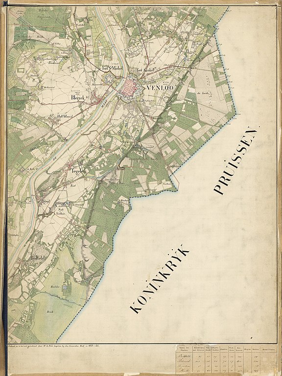
Nederlands: Kaart met Venlo en de omliggende dorpen uit 1843
Limburgs: Kaart mit Venlo en de umliggende dörpe oet 1843 |
| Date | |
| Source | https://www.nationaalarchief.nl/onderzoeken/kaartencollectie/af9b96c0-d0b4-102d-bcf8-003048976d84 |
| Author | W. de Petit |
| Other versions |


| Camera location | | View this and other nearby images on: OpenStreetMap |
|---|
Licensing
edit
| This file is made available under the Creative Commons CC0 1.0 Universal Public Domain Dedication. | |
| The person who associated a work with this deed has dedicated the work to the public domain by waiving all of their rights to the work worldwide under copyright law, including all related and neighboring rights, to the extent allowed by law. You can copy, modify, distribute and perform the work, even for commercial purposes, all without asking permission.
|
File history
Click on a date/time to view the file as it appeared at that time.
| Date/Time | Thumbnail | Dimensions | User | Comment | |
|---|---|---|---|---|---|
| current | 08:17, 13 August 2020 | | 4,202 × 5,600 (4.22 MB) | Hout-blerick (talk | contribs) | Uploaded a work by W. de Petit from https://www.nationaalarchief.nl/onderzoeken/kaartencollectie/af9b96c0-d0b4-102d-bcf8-003048976d84 with UploadWizard |
You cannot overwrite this file.
File usage on Commons
The following 6 pages use this file:
- File:1843 Het Ven in Venlo met omgeving ten noorden van de stad Venlo.jpg
- File:1843 Kaartuitsnede met Boekend en omgeving.jpg
- File:1843 Kaartuitsnede met Hout-Blerick en omgeving.jpg
- File:1843 Landgoed Groethof in het Ven, Venlo met omliggende landgoeden.jpg
- File:Uitsnede met Klein en Groot Boller te Blerick.jpg
- File:Venlo. Blerick met oeververbinding over de Maas, 1843.jpg
File usage on other wikis
The following other wikis use this file:
- Usage on li.wikipedia.org
- Usage on nl.wikipedia.org