File:Owase Shrine (Jinja) - panoramio.jpg
![File:Owase Shrine (Jinja) - panoramio.jpg](https://upload.wikimedia.org/wikipedia/commons/thumb/5/5d/Owase_Shrine_%28Jinja%29_-_panoramio.jpg/800px-Owase_Shrine_%28Jinja%29_-_panoramio.jpg?20160704014442)
Size of this preview: 800 × 600 pixels. Other resolutions: 320 × 240 pixels | 640 × 480 pixels | 1,024 × 768 pixels | 1,280 × 960 pixels | 2,560 × 1,920 pixels | 3,264 × 2,448 pixels.
Original file (3,264 × 2,448 pixels, file size: 4.59 MB, MIME type: image/jpeg)
File information
Structured data
Captions
Captions
Add a one-line explanation of what this file represents
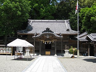
DescriptionOwase Shrine (Jinja) - panoramio.jpg | Owase Shrine (Jinja) | ||
Date | Taken on 3 May 2008 | ||
Source | https://web.archive.org/web/20161013120117/http://www.panoramio.com/photo/14140428 | ||
Author | HIRATA Yasuyuki | ||
Permission (Reusing this file) |
![]() ![]() This file is licensed under the Creative Commons Attribution 3.0 Unported license. Attribution: HIRATA Yasuyuki
|
Camera location | 34° 04′ 37.44″ N, 136° 11′ 45″ E ![]() | View this and other nearby images on: OpenStreetMap | ![]() |
---|
File history
Click on a date/time to view the file as it appeared at that time.
Date/Time | Thumbnail | Dimensions | User | Comment | |
---|---|---|---|---|---|
current | 01:44, 4 July 2016 | ![]() | 3,264 × 2,448 (4.59 MB) | Panoramio upload bot (talk | contribs) | {{Information |description=Owase Shrine (Jinja) |date={{Taken on|2008-05-03}} |source=http://www.panoramio.com/photo/14140428 |author=[http://www.panoramio.com/user/2248926?with_photo_id=14140428 HIRATA Yasuyuki] |permission={{cc-by-3.0|HIRATA Yasuyuki... |
You cannot overwrite this file.
File usage on Commons
The following page uses this file:
File usage on other wikis
The following other wikis use this file:
- Usage on eo.wikipedia.org
- Usage on id.wikipedia.org
- Usage on ja.wikipedia.org
- Usage on ja.wikivoyage.org
- Usage on www.wikidata.org
Metadata
This file contains additional information such as Exif metadata which may have been added by the digital camera, scanner, or software program used to create or digitize it. If the file has been modified from its original state, some details such as the timestamp may not fully reflect those of the original file. The timestamp is only as accurate as the clock in the camera, and it may be completely wrong.
Camera manufacturer | Canon |
---|---|
Camera model | Canon IXY DIGITAL 20 IS |
Exposure time | 1/640 sec (0.0015625) |
F-number | f/3.2 |
ISO speed rating | 80 |
Date and time of data generation | 12:18, 3 May 2008 |
Lens focal length | 7.23 mm |
Latitude | 34° 4′ 37.44″ N |
Longitude | 136° 11′ 45″ E |
Altitude | 0 meters above sea level |
Orientation | Normal |
Horizontal resolution | 180 dpi |
Vertical resolution | 180 dpi |
File change date and time | 12:18, 3 May 2008 |
Y and C positioning | Centered |
Software used | DIGICAM PLUGIN for KASHMIR3D |
Exif version | 2.2 |
Date and time of digitizing | 12:18, 3 May 2008 |
Meaning of each component |
|
Image compression mode | 5 |
APEX shutter speed | 9.3125 |
APEX aperture | 3.34375 |
APEX exposure bias | 0 |
Maximum land aperture | 3.34375 APEX (f/3.19) |
Metering mode | Pattern |
Flash | Flash did not fire, auto mode |
Supported Flashpix version | 1 |
Color space | sRGB |
Focal plane X resolution | 14,506.666666667 |
Focal plane Y resolution | 14,485.207100592 |
Focal plane resolution unit | inches |
Sensing method | One-chip color area sensor |
File source | Digital still camera |
Custom image processing | Normal process |
Exposure mode | Auto exposure |
White balance | Auto white balance |
Digital zoom ratio | 1 |
Scene capture type | Standard |
Geodetic survey data used | WGS84 |
GPS tag version | 2.0.0.0 |