File:Oxleas Meadows - geograph.org.uk - 1134120.jpg
No higher resolution available.
Oxleas_Meadows_-_geograph.org.uk_-_1134120.jpg (640 × 480 pixels, file size: 104 KB, MIME type: image/jpeg)
Captions
Captions
Add a one-line explanation of what this file represents
Summary
edit
| Description |
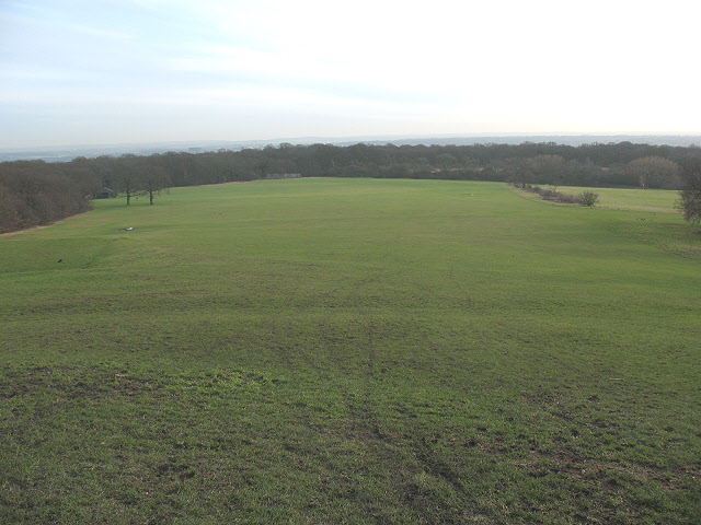
English: Oxleas Meadows This large open space on the south flank of Shooters Hill, formerly the grounds of Wood Lodge, has been open to the public since the 1930s. There is a service reservoir buried beneath the south-east corner of it (in the distance on this photo, just before the trees). More detail can be found at http://www.greenwich.gov.uk/NR/rdonlyres/95FA096E-7B56-479F-B305-5A04A7362D6F/0/OxleasWoodland.pdf |
| Date | |
| Source | From geograph.org.uk |
| Author | Stephen Craven |
| Attribution (required by the license) | Stephen Craven / Oxleas Meadows / |
| Camera location | | View this and other nearby images on: OpenStreetMap |
|---|
_heading:157.00&language=en)
| Object location | | View this and other nearby images on: OpenStreetMap |
|---|
_heading:157.00&language=en)
Licensing
edit

|
This image was taken from the Geograph project collection. See this photograph's page on the Geograph website for the photographer's contact details. The copyright on this image is owned by Stephen Craven and is licensed for reuse under the Creative Commons Attribution-ShareAlike 2.0 license.
|
This file is licensed under the Creative Commons Attribution-Share Alike 2.0 Generic license.
Attribution: Stephen Craven
- You are free:
- to share – to copy, distribute and transmit the work
- to remix – to adapt the work
- Under the following conditions:
- attribution – You must give appropriate credit, provide a link to the license, and indicate if changes were made. You may do so in any reasonable manner, but not in any way that suggests the licensor endorses you or your use.
- share alike – If you remix, transform, or build upon the material, you must distribute your contributions under the same or compatible license as the original.
File history
Click on a date/time to view the file as it appeared at that time.
| Date/Time | Thumbnail | Dimensions | User | Comment | |
|---|---|---|---|---|---|
| current | 04:24, 25 February 2011 | | 640 × 480 (104 KB) | GeographBot (talk | contribs) | == {{int:filedesc}} == {{Information |description={{en|1=Oxleas Meadows This large open space on the south flank of Shooters Hill, formerly the grounds of Wood Lodge, has been open to the public since the 1930s. There is a service reservoir buried beneat |
You cannot overwrite this file.
File usage on Commons
There are no pages that use this file.