File:Ozu city center area Aerial photograph.2013.jpg

Size of this preview: 634 × 599 pixels. Other resolutions: 254 × 240 pixels | 508 × 480 pixels | 813 × 768 pixels | 1,084 × 1,024 pixels | 2,167 × 2,048 pixels | 10,167 × 9,607 pixels.
Original file (10,167 × 9,607 pixels, file size: 33.43 MB, MIME type: image/jpeg)
Captions
Captions
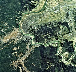
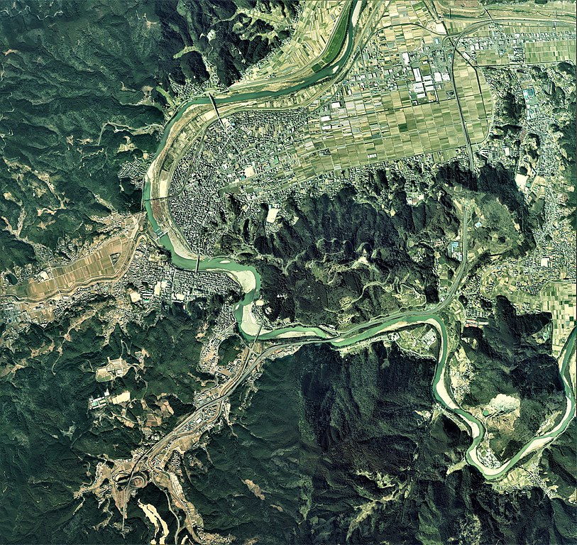
Ozu city center area Aerial photograph.2013
Summary edit
| Warning | The original file is very high-resolution. It might not load properly or could cause your browser to freeze when opened at full size. |
|---|
| Description |
日本語: 大洲市(愛媛県)中心部周辺の空中写真。CSI20125-C7-20からCSI20125-C7-24、CSI20125-C8-19からCSI20125-C8-23、CSI20125-C9-18からCSI20125-C9-22の合計15枚を合成作成。
English: Ozu city center area Aerial photograph.2013 |
| Date | |
| Source | 国土情報ウェブマッピングシステム |
| Author | 国土地理 |
Licensing edit

|
The copyright holder of this file, the Ministry of Land, Infrastructure, Transport and Tourism of Japan, allows anyone to use it for any purpose, provided that the copyright holder is properly attributed. Redistribution, derivative work, commercial use, and all other use is permitted. |
Attribution:
Copyright © National Land Image Information (Color Aerial Photographs), Ministry of Land, Infrastructure, Transport and Tourism
|
 |
This image is copyrighted by the Ministry of Land, Infrastructure, Transport and Tourism of Japan. For terms of use, see the stipulation to use of National Land Information (in Japanese) and message from MLIT (in Japanese and English). When you display this image on an article, include the following phrase in the description: "Made based on National Land Image Information (Color Aerial Photographs), Ministry of Land, Infrastructure, Transport and Tourism".
|
File history
Click on a date/time to view the file as it appeared at that time.
| Date/Time | Thumbnail | Dimensions | User | Comment | |
|---|---|---|---|---|---|
| current | 02:47, 16 February 2021 | | 10,167 × 9,607 (33.43 MB) | さかおり (talk | contribs) | Uploaded a work by 国土地理 from 国土情報ウェブマッピングシステム with UploadWizard |
You cannot overwrite this file.
File usage on Commons
There are no pages that use this file.
File usage on other wikis
The following other wikis use this file:
- Usage on ja.wikipedia.org