File:PA 329 map.svg

Size of this PNG preview of this SVG file: 772 × 542 pixels. Other resolutions: 320 × 225 pixels | 640 × 449 pixels | 1,024 × 719 pixels | 1,280 × 899 pixels | 2,560 × 1,797 pixels.
Original file (SVG file, nominally 772 × 542 pixels, file size: 3.32 MB)
Captions
Captions
Add a one-line explanation of what this file represents
| Description |
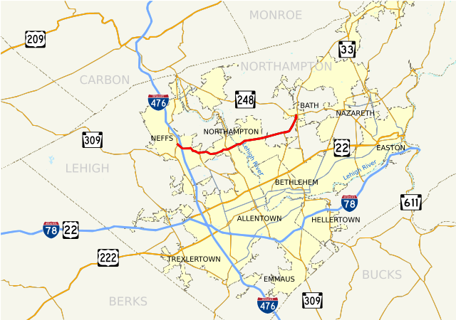
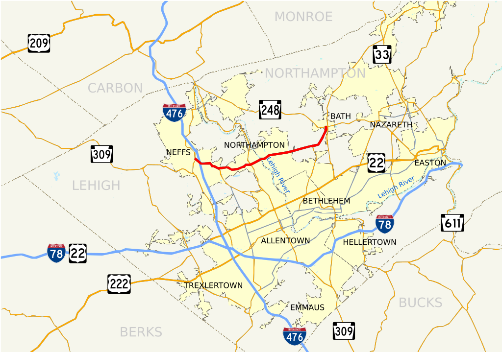
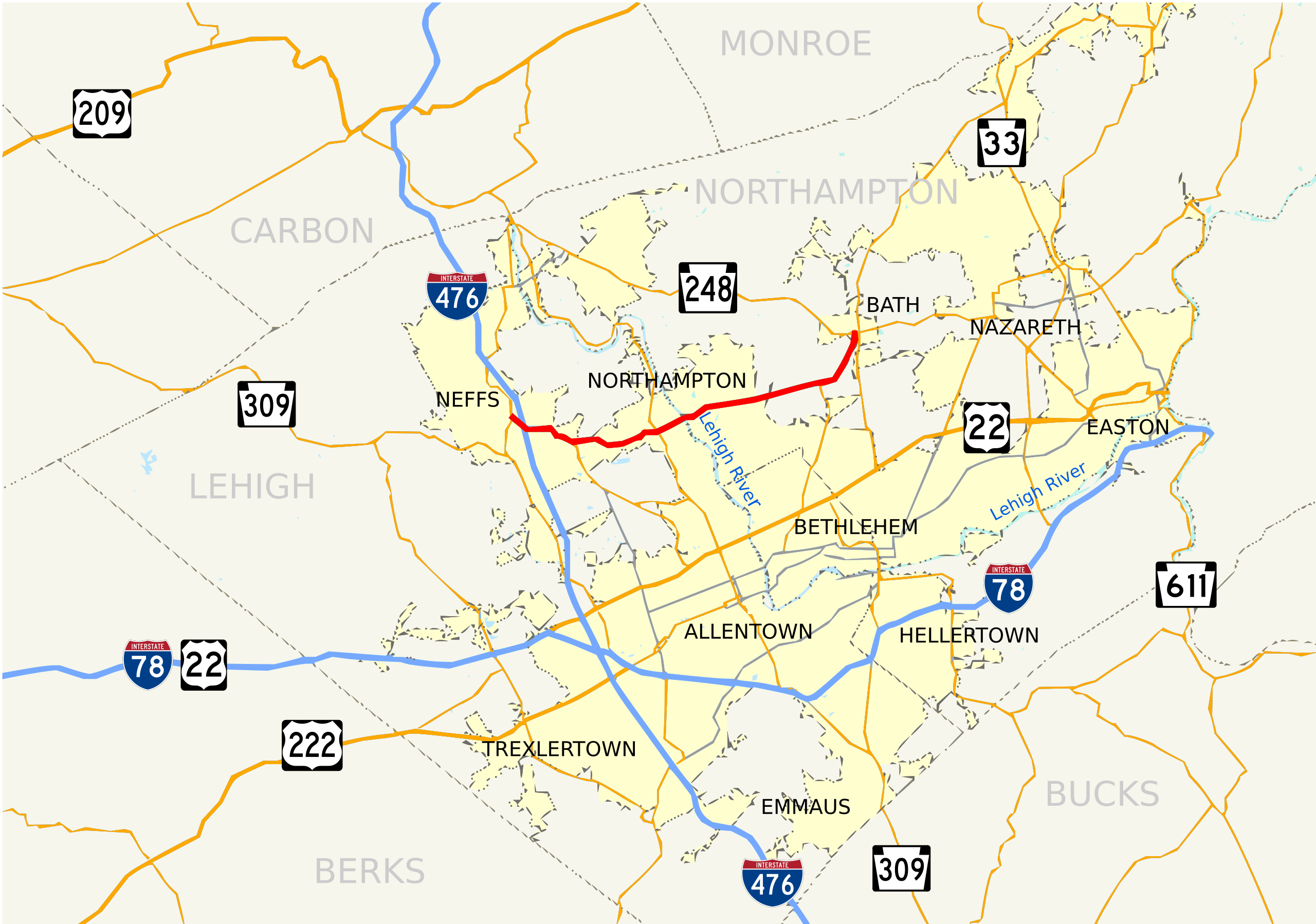
English: Road map of Pennsylvania Route 329.
This W3C-unspecified vector image was created with Inkscape . |
||
| Date | |||
| Source | Own work | ||
| Author | JohnnyAlbert10 | ||
| Permission (Reusing this file) |
|
File history
Click on a date/time to view the file as it appeared at that time.
| Date/Time | Thumbnail | Dimensions | User | Comment | |
|---|---|---|---|---|---|
| current | 06:50, 4 August 2009 | | 772 × 542 (3.32 MB) | JohnnyAlbert10~commonswiki (talk | contribs) | Fixed overwrite |
| 06:25, 4 August 2009 |  | 772 × 542 (115 KB) | JohnnyAlbert10~commonswiki (talk | contribs) | {{Information |Description={{en|1=Road map of Pennsylvania Route 329. {{Inkscape}}}} |Source=Own work by uploader |Author=JohnnyAlbert10 |Date=2009-08-04 |Permission={{PD-self}} |other_versions= }} |
You cannot overwrite this file.
File usage on Commons
The following 3 pages use this file:
File usage on other wikis
The following other wikis use this file:
- Usage on en.wikipedia.org
- Usage on www.wikidata.org