File:PERU MAPA 1865.JPG

Original file (6,556 × 9,208 pixels, file size: 3.31 MB, MIME type: image/jpeg)
Captions
Captions
| Warning | The original file is very high-resolution. It might not load properly or could cause your browser to freeze when opened at full size. |
|---|
Summary
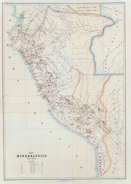
edit| Description | Mapa mineralógico del Perú, hacia 1865. Paz Soldan. Geografia del Peru. Grabado por Delamare, Calle St. Andre des Arts, 45, Paris. Paris, Imp. Janson, Calle Antne. Dubois, 6. (Paris, Libreria de Augusto Durand, 1865) |
| Date | |
| Source | Cartography Associates - Atlas geografico del Peru, publicado a expensas del Gobierno Peruano, siendo Presidente el Libertador Gran Mariscal Ramon Castilla, por Mariano Felipe Paz Soldan. Paris, Libreria de Augusto Durand, Calle de Gres-Sorbonne, 7. 1865. Paris. - Imprenta de Ad. Laine y J. Havard, Calle des Saints-Peres, No. 19. |
| Author | Paz Soldan, Mariano Felipe (1821-1886) |
| Permission (Reusing this file) |
PD-Art |
Licensing
editThis image is in the public domain because it is a mere mechanical scan or photocopy of a public domain original, or – from the available evidence – is so similar to such a scan or photocopy that no copyright protection can be expected to arise. The original itself is in the public domain for the following reason:
This tag is designed for use where there may be a need to assert that any enhancements (eg brightness, contrast, colour-matching, sharpening) are in themselves insufficiently creative to generate a new copyright. It can be used where it is unknown whether any enhancements have been made, as well as when the enhancements are clear but insufficient. For known raw unenhanced scans you can use an appropriate {{PD-old}} tag instead. For usage, see Commons:When to use the PD-scan tag.  |

File history
Click on a date/time to view the file as it appeared at that time.
| Date/Time | Thumbnail | Dimensions | User | Comment | |
|---|---|---|---|---|---|
| current | 19:09, 8 August 2007 | | 6,556 × 9,208 (3.31 MB) | Achata (talk | contribs) | ==Summary== {{Information |Description=Mapa mineralógico del Perú, hacia 1865. Paz Soldan. Geografia del Peru. Grabado por Delamare, Calle St. Andre des Arts, 45, Paris. Paris, Imp. Janson, Calle Antne. Dubois, 6. (Paris, Libreria de Augusto Durand, |
You cannot overwrite this file.
File usage on Commons
There are no pages that use this file.
File usage on other wikis
The following other wikis use this file:
- Usage on ast.wikipedia.org
- Usage on ca.wikipedia.org
- Usage on en.wikipedia.org
- Usage on es.wikipedia.org
- Usage on ru.wikipedia.org