File:PIA16202-MarsCuriosityRover-TowardGlenelg-Panorama-20121001.jpg

Size of this preview: 800 × 152 pixels. Other resolutions: 320 × 61 pixels | 640 × 122 pixels | 1,024 × 195 pixels | 1,280 × 243 pixels | 7,824 × 1,488 pixels.
Original file (7,824 × 1,488 pixels, file size: 1.05 MB, MIME type: image/jpeg)
Captions
Captions
Add a one-line explanation of what this file represents
Summary
edit
| Description |
English: 10.04.2012
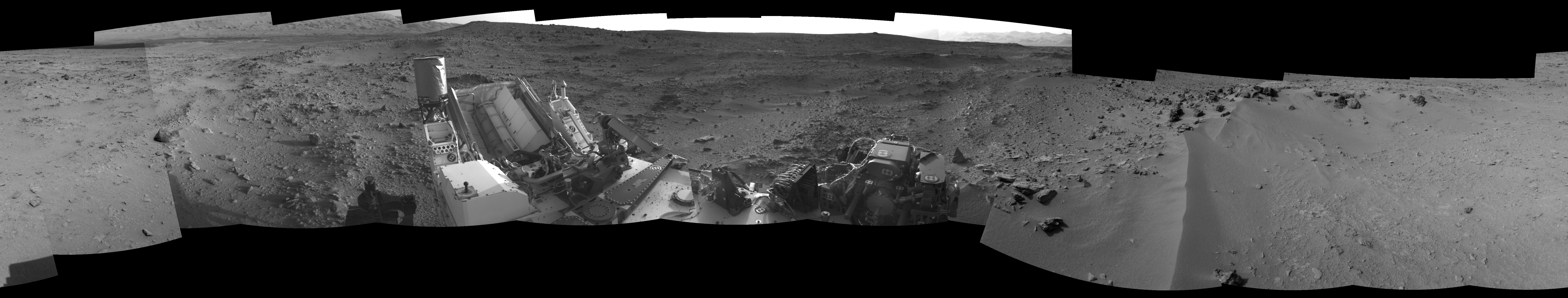
View on the Way to 'Glenelg' This 360-degree panorama from NASA's Mars rover Curiosity shows the rocky terrain surrounding it as of its 55th Martian day, or sol, of the mission (Oct. 1, 2012). The base of Mount Sharp can be seen at upper left. The sandy area seen to the right is a region called "Rocknest," which is the current candidate for Curiosity's first scooping experiments on Mars. This image was taken by the rover's Navigation camera. Image Credit: NASA/JPL-Caltech |
| Date | |
| Source | http://photojournal.jpl.nasa.gov/jpeg/PIA16202.jpg |
| Author | NASA/JPL-Caltech |
| Other versions | http://photojournal.jpl.nasa.gov/catalog/PIA16202 |
Licensing
edit
| This file is in the public domain in the United States because it was solely created by NASA. NASA copyright policy states that "NASA material is not protected by copyright unless noted". (See Template:PD-USGov, NASA copyright policy page or JPL Image Use Policy.) | ||
 |
Warnings:
|
File history
Click on a date/time to view the file as it appeared at that time.
| Date/Time | Thumbnail | Dimensions | User | Comment | |
|---|---|---|---|---|---|
| current | 16:59, 5 October 2012 | 7,824 × 1,488 (1.05 MB) | Drbogdan (talk | contribs) | User created page with UploadWizard |
You cannot overwrite this file.
File usage on Commons
There are no pages that use this file.
File usage on other wikis
The following other wikis use this file:
- Usage on lb.wikipedia.org
- Usage on ru.wikipedia.org
- Usage on zh.wikipedia.org