File:POL powiat oszmiański map.svg

Size of this PNG preview of this SVG file: 689 × 600 pixels. Other resolutions: 276 × 240 pixels | 551 × 480 pixels | 882 × 768 pixels | 1,176 × 1,024 pixels | 2,352 × 2,048 pixels | 750 × 653 pixels.
Original file (SVG file, nominally 750 × 653 pixels, file size: 28 KB)
Captions
Captions
Add a one-line explanation of what this file represents
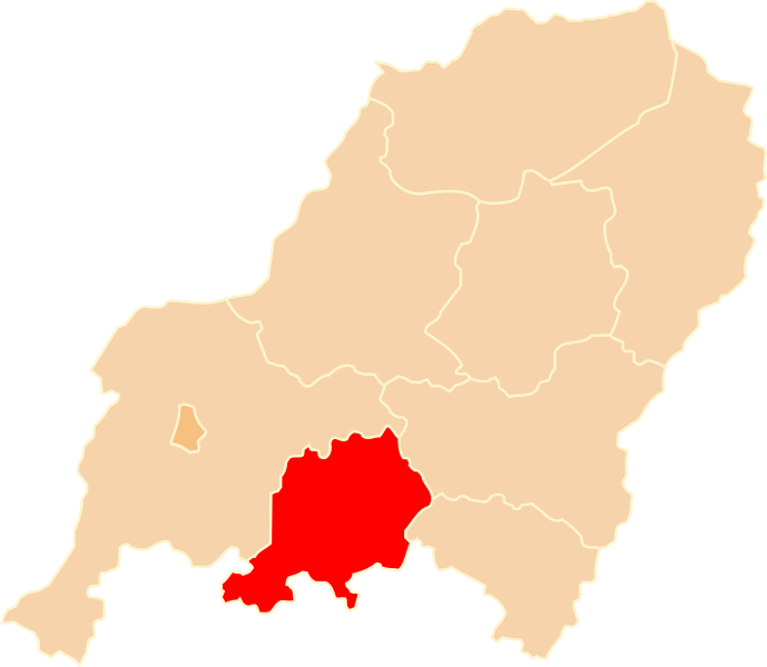
| Description | Położenie powiatu oszmiańskiego na mapie województwa wileńskiego |
| Date | |
| Source | Own work |
| Author | Poznaniak |
| Permission (Reusing this file) |
This file is licensed under the Creative Commons Attribution-Share Alike 2.5 Generic license.
|
File history
Click on a date/time to view the file as it appeared at that time.
| Date/Time | Thumbnail | Dimensions | User | Comment | |
|---|---|---|---|---|---|
| current | 16:37, 28 December 2008 | | 750 × 653 (28 KB) | Poznaniak (talk | contribs) | {{Information |Description=Położenie powiatu oszmiańskiego na mapie województwa wileńskiego |Source=własna praca |Date=28.12.2008 |Author=Poznaniak |Permission={{cc-by-sa-2.5}} }} [[Category:Locator map |
You cannot overwrite this file.
File usage on Commons
There are no pages that use this file.
File usage on other wikis
The following other wikis use this file:
- Usage on be.wikipedia.org
- Usage on lt.wikipedia.org
- Usage on pl.wikipedia.org
- Usage on www.wikidata.org