File:PT-TT-CMP-0015 m0001 derivada.jpg

Size of this preview: 678 × 599 pixels. Other resolutions: 272 × 240 pixels | 543 × 480 pixels | 869 × 768 pixels | 1,159 × 1,024 pixels | 2,318 × 2,048 pixels | 4,273 × 3,776 pixels.
Original file (4,273 × 3,776 pixels, file size: 4.48 MB, MIME type: image/jpeg)
Captions
Captions
Add a one-line explanation of what this file represents
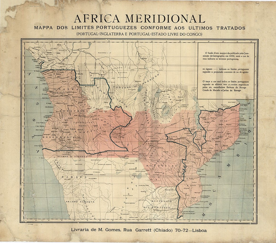
| Description | África meridional - Mapa dos limites portugueses conforme os últimos Tratados (Portugal - Inglaterra e Portugal - Estado Livre do Congo). [1886?]. | ||
| Date | |||
| Source |
Localização: ColecçãoCMP Colecção de Mapas e Planos : Unidade de instalação0015 Rolo 15 1870/1899: |
||
| Author | Unknown author | ||
| Permission (Reusing this file) |
|
File history
Click on a date/time to view the file as it appeared at that time.
| Date/Time | Thumbnail | Dimensions | User | Comment | |
|---|---|---|---|---|---|
| current | 01:21, 5 December 2019 | | 4,273 × 3,776 (4.48 MB) | Lubiesque (talk | contribs) | Map straightened up |
| 16:22, 26 December 2013 |  | 4,663 × 3,777 (2.23 MB) | JotaCartas (talk | contribs) | {{Information |Description= |Source= |Date= |Author= |Permission= |other_versions= }} |
You cannot overwrite this file.
File usage on Commons
The following 2 pages use this file:
File usage on other wikis
The following other wikis use this file:
- Usage on de.wikipedia.org