File:Paka-Platz an der Alte-Heer-Str. gegenüber dem Rathaus.jpg
Size of this preview: 800 × 600 pixels. Other resolutions: 320 × 240 pixels | 640 × 480 pixels | 1,024 × 768 pixels | 1,280 × 960 pixels | 2,560 × 1,920 pixels | 5,664 × 4,248 pixels.
Original file (5,664 × 4,248 pixels, file size: 10.17 MB, MIME type: image/jpeg)
Captions
Captions
Add a one-line explanation of what this file represents
Summary
edit
| Description |
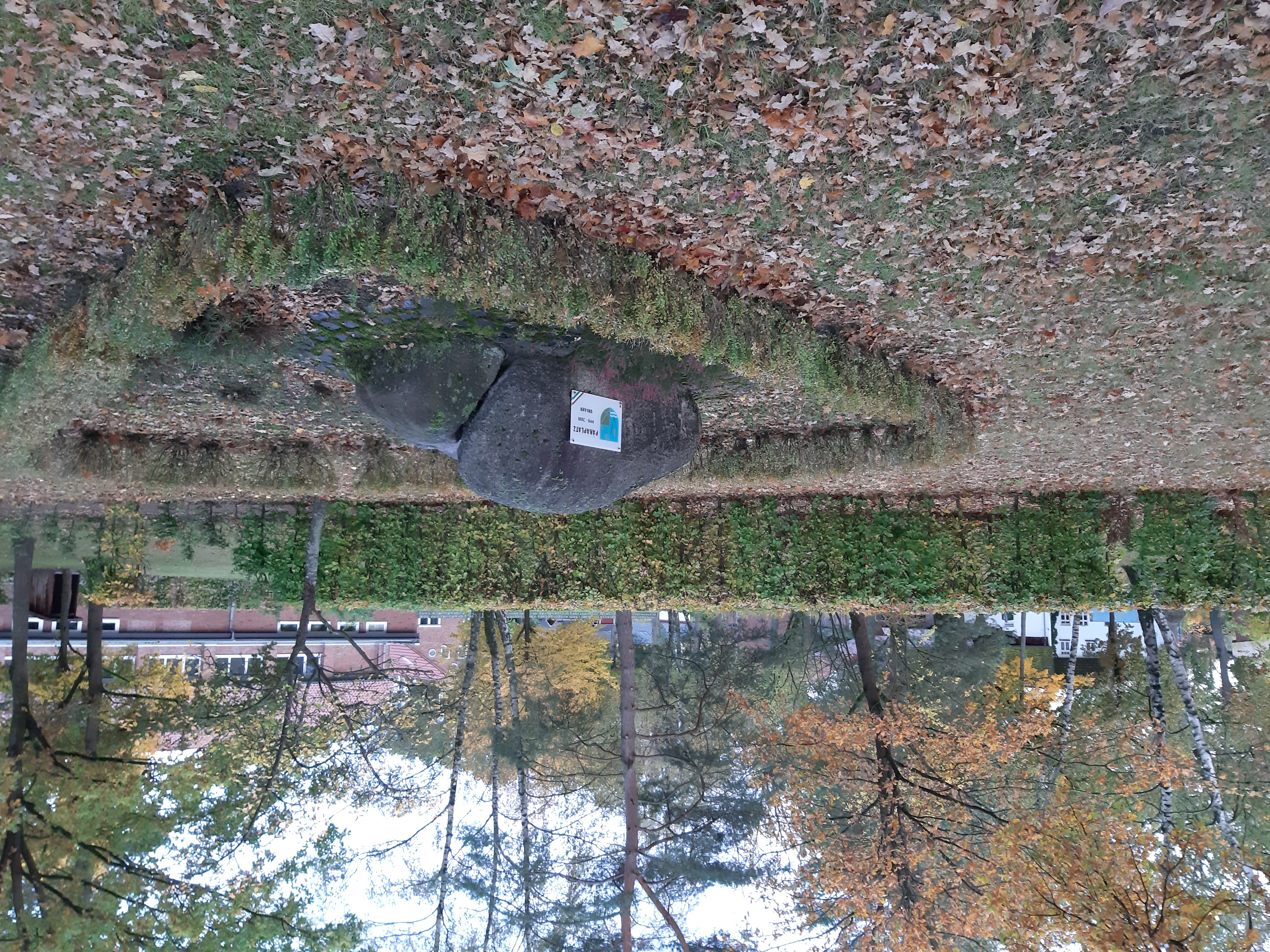
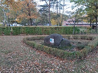
Deutsch: "Paka-Platz" - angelegt zum Gedenken an die zahlreichen Gefallenen (alliierter Bombenangriff im April 1945) u. zum Erinnern an die Partnerschaft zwischen den Gemeinden Wesendorf und Paka / Ungarn |
| Date | |
| Source | Own work |
| Author | Thomas Frankewitsch |
| Camera location | | View this and other nearby images on: OpenStreetMap |
|---|
Licensing
edit
I, the copyright holder of this work, hereby publish it under the following license:
This file is licensed under the Creative Commons Attribution-Share Alike 4.0 International license.
- You are free:
- to share – to copy, distribute and transmit the work
- to remix – to adapt the work
- Under the following conditions:
- attribution – You must give appropriate credit, provide a link to the license, and indicate if changes were made. You may do so in any reasonable manner, but not in any way that suggests the licensor endorses you or your use.
- share alike – If you remix, transform, or build upon the material, you must distribute your contributions under the same or compatible license as the original.
File history
Click on a date/time to view the file as it appeared at that time.
| Date/Time | Thumbnail | Dimensions | User | Comment | |
|---|---|---|---|---|---|
| current | 14:11, 2 November 2021 | | 5,664 × 4,248 (10.17 MB) | Thomas Frankewitsch (talk | contribs) | Cross-wiki upload from de.wikipedia.org |
You cannot overwrite this file.
File usage on Commons
There are no pages that use this file.
File usage on other wikis
The following other wikis use this file:
- Usage on de.wikipedia.org