File:Pam.Deska.Josef.Bryks.(1916-1957).Cerny.Most.Praha.CZ.jpg

Size of this preview: 800 × 600 pixels. Other resolutions: 320 × 240 pixels | 640 × 480 pixels | 1,024 × 768 pixels | 1,280 × 960 pixels | 2,560 × 1,920 pixels | 4,608 × 3,456 pixels.
Original file (4,608 × 3,456 pixels, file size: 3.19 MB, MIME type: image/jpeg)
Captions
Captions
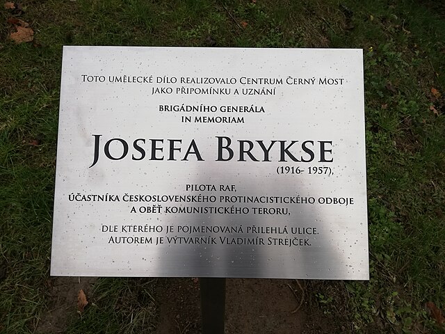
Explaining memorial plaque placed near at the mural art (on stairs) portrait of Josef Bryks (1916 - 1957) by Czech artist Vladimír Strejček. (Czech Republic, Prague 14, housing estate Černý Most)
Summary edit
.Cerny.Most.Praha.CZ.jpg&action=edit§ion=1)
| Description |
Čeština: Josefa Brykse připomíná mural artové dílo českého grafika a ilustrátora Vladimíra Strejčka na Praze 14 na pozemku Centra Černý Most. Malba – velkoformátový portrét – o rozměrech asi 1,7 x 5 metrů se nachází na schodišti, které spojuje východní a západní část Bryksovy ulice poblíž křižovatky s ulicí Vybíralovou (GPS souřadnice: 50°6'19.202"N, 14°34'58.108"E). V pondělí 28 října 2019 byla malba doplněna o plaketu s následujícím textem: „Toto umělecké dílo realizovalo Centrum Černý Most / jako připomínku a uznání // brigádního generála / in memoriam / JOSEFA BRYKSE (1916 – 1957), // pilota RAF, / účastníka československého protinacistického odboje / a oběť komunistického teroru, // dle kterého je pojmenována přilehlá ulice. / Autorem je výtvarník Vladimír Strejček.“
English: Josef Bryks is reminiscent of a mural art work (on stairs) by Czech graphic artist and illustrator Vladimír Strejček in Prague 14 on the site of the Černý Most Center. Painting - large format portrait - measuring about 1.7 x 5 meters is located on a staircase that connects the eastern and western parts of Bryks Street near the intersection with Vybíralová Street (GPS coordinates: 50 ° 6'19.202 "N, 14 ° 34'58.108" E). On Monday, October 28, 2019, the painting was accompanied by a memorial plaque with the following text: “This artwork was realized by Centrum Černý Most / as a reminder and recognition // of Brigadier General / in memoriam / JOSEF BRYKS (1916 - 1957) // RAF pilot / participant Czechoslovak anti-Nazi resistance / and a victim of communist terror, // by which name is named the adjacent street. / The author is the artist Vladimír Strejček.” |
| Date | |
| Source | Own work |
| Author | Mojmir Churavy |
| Camera location | | View this and other nearby images on: OpenStreetMap |
|---|
.Cerny.Most.Praha.CZ.jpg¶ms=050.105334_N_0014.582808_E_globe:Earth_type:camera__&language=en)
Licensing edit
.Cerny.Most.Praha.CZ.jpg&action=edit§ion=2)
I, the copyright holder of this work, hereby publish it under the following license:
This file is licensed under the Creative Commons Attribution-Share Alike 4.0 International license.
- You are free:
- to share – to copy, distribute and transmit the work
- to remix – to adapt the work
- Under the following conditions:
- attribution – You must give appropriate credit, provide a link to the license, and indicate if changes were made. You may do so in any reasonable manner, but not in any way that suggests the licensor endorses you or your use.
- share alike – If you remix, transform, or build upon the material, you must distribute your contributions under the same or compatible license as the original.
File history
Click on a date/time to view the file as it appeared at that time.
| Date/Time | Thumbnail | Dimensions | User | Comment | |
|---|---|---|---|---|---|
| current | 08:46, 4 November 2019 | | 4,608 × 3,456 (3.19 MB) | Mojmir Churavy (talk | contribs) | User created page with UploadWizard |
You cannot overwrite this file.
File usage on Commons
The following page uses this file:
File usage on other wikis
The following other wikis use this file:
- Usage on cs.wikipedia.org
.Cerny.Most.Praha.CZ.jpg&oldid=632085840)