File:Pannonia.svg

Size of this PNG preview of this SVG file: 560 × 599 pixels. Other resolutions: 224 × 240 pixels | 449 × 480 pixels | 718 × 768 pixels | 957 × 1,024 pixels | 1,914 × 2,048 pixels | 702 × 751 pixels.
Original file (SVG file, nominally 702 × 751 pixels, file size: 16 KB)
Captions
Captions
Add a one-line explanation of what this file represents
Summary
edit
| Description |
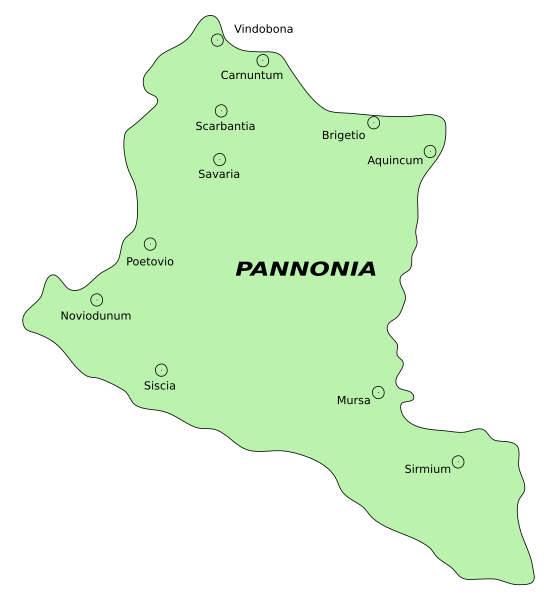
English: Historic map of Roman province of Pannonia
Српски (ћирилица): историјска мапа римске провинције Паноније
Srpski (latinica): istorijska mapa rimske provincije Panonije
|
| Date | 27 May 2006/19 November 2006 |
| Source | en:Image:Pannonia01.png |
| Author | PANONIAN, vectorised by Nikola Smolenski |
| Permission (Reusing this file) |
|
| Other versions | en:Image:Pannonia01.png |
![[1]](https://en.wikipedia.org/w/index.php?title=Image:Pannonia01.png&diff=55420861&oldid=55420670)
| This work has been released into the public domain by its author, PANONIAN. This applies worldwide. In some countries this may not be legally possible; if so: |
File history
Click on a date/time to view the file as it appeared at that time.
| Date/Time | Thumbnail | Dimensions | User | Comment | |
|---|---|---|---|---|---|
| current | 09:25, 19 November 2006 | | 702 × 751 (16 KB) | Nikola Smolenski (talk | contribs) | {{Information |Description=Historic map of Panonia ;Original caption: :historic map (self made) |Source=en:Image:Pannonia01.png |Date=27 May 2006/19 November 2006 |Author=User:PANONIAN, vectorised by User:Nikola Smolenski |Permission=[http |
You cannot overwrite this file.
File usage on Commons
There are no pages that use this file.