File:Panoramic view of Brussels.jpg

Size of this preview: 800 × 287 pixels. Other resolutions: 320 × 115 pixels | 640 × 230 pixels | 1,024 × 368 pixels | 1,280 × 460 pixels | 2,560 × 919 pixels | 8,243 × 2,960 pixels.
Original file (8,243 × 2,960 pixels, file size: 6.01 MB, MIME type: image/jpeg)
Captions
Captions
Add a one-line explanation of what this file represents
Summary edit
| Description | |
| Date | |
| Source | Own work |
| Author | Niels Mickers |
| Camera location | | View this and other nearby images on: OpenStreetMap |
|---|
Licensing edit
Niels Mickers, the copyright holder of this work, hereby publishes it under the following license:
This file is licensed under the Creative Commons Attribution 3.0 Netherlands license.
Attribution: Niels Mickers
- You are free:
- to share – to copy, distribute and transmit the work
- to remix – to adapt the work
- Under the following conditions:
- attribution – You must give appropriate credit, provide a link to the license, and indicate if changes were made. You may do so in any reasonable manner, but not in any way that suggests the licensor endorses you or your use.

File history
Click on a date/time to view the file as it appeared at that time.
| Date/Time | Thumbnail | Dimensions | User | Comment | |
|---|---|---|---|---|---|
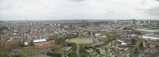
| current | 23:55, 15 April 2011 | 8,243 × 2,960 (6.01 MB) | NielsMickers (talk | contribs) | {{Information |Description ={{en|1=Panoramic view of Brussels, picture taken from the top globe of the Atomium.}} {{nl|1=Het beeld Brussel, gemaakt vanaf de bovenste bol van het [[:nl:Atom |
You cannot overwrite this file.
File usage on Commons
The following page uses this file: