File:Panoramic view on Würzburg from Marienberg Fortress - panoramio (4).jpg

Size of this preview: 800 × 94 pixels. Other resolutions: 320 × 37 pixels | 640 × 75 pixels | 1,024 × 120 pixels | 1,280 × 150 pixels | 2,560 × 300 pixels | 18,486 × 2,163 pixels.
Original file (18,486 × 2,163 pixels, file size: 10.62 MB, MIME type: image/jpeg)
Captions
Captions
Add a one-line explanation of what this file represents
Summary
edit.jpg&action=edit§ion=1)
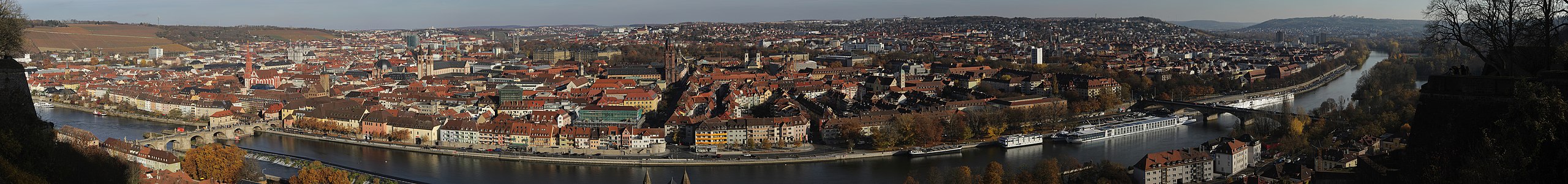
| Description | Panoramic view on Würzburg from Marienberg Fortress | ||
| Date | Taken on 8 November 2015 | ||
| Source | https://web.archive.org/web/20161031205426/http://www.panoramio.com/photo/125430683 | ||
| Author | Björn S. | ||
| Permission (Reusing this file) |
This file is licensed under the Creative Commons Attribution-Share Alike 3.0 Unported license. Attribution: Björn S.
|
||
| Panoramio Tags | Würzburg |
| Camera location | | View this and other nearby images on: OpenStreetMap |
|---|
.jpg¶ms=049.789860_N_0009.922274_E_globe:Earth_type:camera_source:Panoramio_&language=en)
File history
Click on a date/time to view the file as it appeared at that time.
| Date/Time | Thumbnail | Dimensions | User | Comment | |
|---|---|---|---|---|---|
| current | 16:02, 15 June 2017 | 18,486 × 2,163 (10.62 MB) | Panoramio upload bot (talk | contribs) | == {{int:filedesc}} == {{Information |description=Panoramic view on Würzburg from Marienberg Fortress |date={{Taken on|2015-11-08}} |source=http://www.panoramio.com/photo/125430683 |author=[http://www.panoramio.com/user/6004592?with_photo_id=125430683... |
You cannot overwrite this file.
File usage on Commons
There are no pages that use this file.
.jpg&oldid=723612460)