File:Paradise Valley.jpg
Size of this preview: 800 × 600 pixels. Other resolutions: 320 × 240 pixels | 640 × 480 pixels | 1,024 × 768 pixels | 1,280 × 960 pixels | 2,272 × 1,704 pixels.
Original file (2,272 × 1,704 pixels, file size: 2.79 MB, MIME type: image/jpeg)
Captions
Captions
Add a one-line explanation of what this file represents
Summary
edit
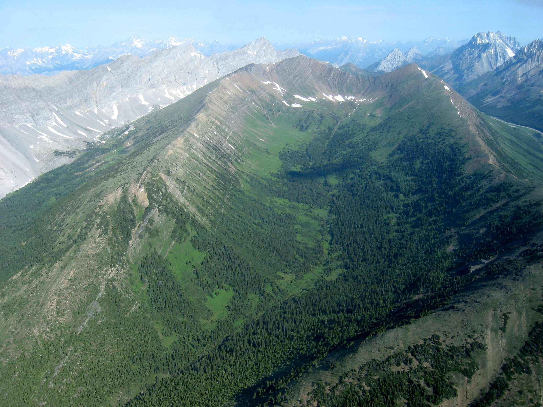
Paradise Valley viewed from the south looking north. Kananaskis highway 40 and the Highwood Pass parking lot can be seen in the top right corner. Highwood Ridge is on the right. Grizzly Ridge is on the left. Grizzly col is on the top left.
Licensing
edit
This file is licensed under the Creative Commons Attribution-Share Alike 2.5 Generic license.
- You are free:
- to share – to copy, distribute and transmit the work
- to remix – to adapt the work
- Under the following conditions:
- attribution – You must give appropriate credit, provide a link to the license, and indicate if changes were made. You may do so in any reasonable manner, but not in any way that suggests the licensor endorses you or your use.
- share alike – If you remix, transform, or build upon the material, you must distribute your contributions under the same or compatible license as the original.
| Annotations | This image is annotated: View the annotations at Commons |
File history
Click on a date/time to view the file as it appeared at that time.
| Date/Time | Thumbnail | Dimensions | User | Comment | |
|---|---|---|---|---|---|
| current | 02:30, 3 October 2006 | | 2,272 × 1,704 (2.79 MB) | Kevin Lenz (talk | contribs) | Paradise Valley viewed from the south looking north. Kananaskis highway 40 and the Highwood Pass parking lot can be seen in the top right corner. Highwood Ridge is on the right. Grizzly Ridge is on the left. Grizzly col is on the top left. |
You cannot overwrite this file.
File usage on Commons
There are no pages that use this file.
File usage on other wikis
The following other wikis use this file:
- Usage on en.wikipedia.org
- Usage on www.wikidata.org