File:Parc Coeur Nature panneau.jpg
![File:Parc Coeur Nature panneau.jpg](https://upload.wikimedia.org/wikipedia/commons/thumb/1/16/Parc_Coeur_Nature_panneau.jpg/800px-Parc_Coeur_Nature_panneau.jpg?20230322092720)
Size of this preview: 800 × 600 pixels. Other resolutions: 320 × 240 pixels | 640 × 480 pixels | 1,024 × 768 pixels | 1,280 × 960 pixels | 2,560 × 1,920 pixels | 4,032 × 3,024 pixels.
Original file (4,032 × 3,024 pixels, file size: 5.11 MB, MIME type: image/jpeg)
File information
Structured data
Captions
Captions
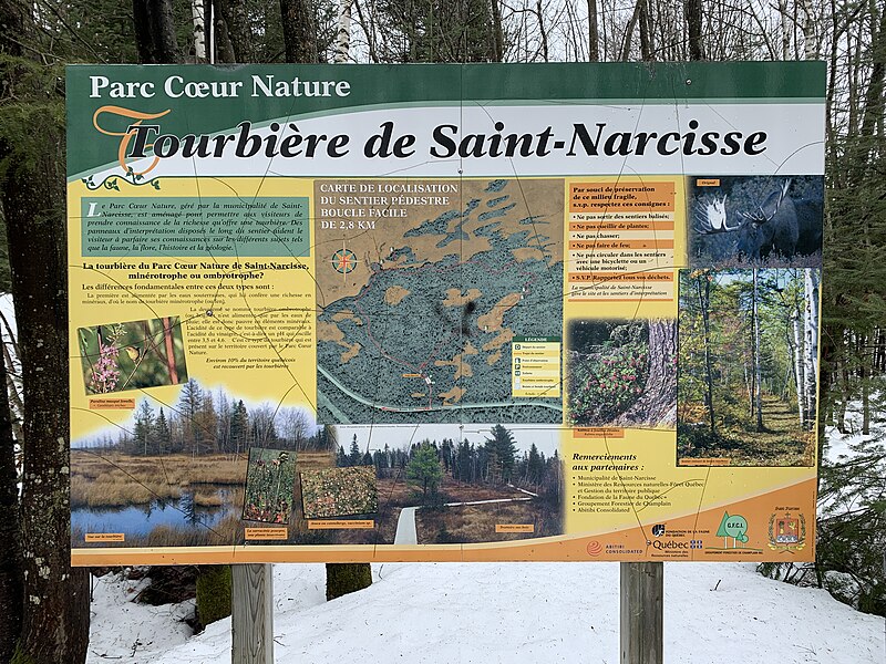
Parc Cœur Nature, informations on the bog and map of the hiking trail
Parc Coeur Nature, informations sur la tourbière et carte du sentier pédestre
Summary
editDescriptionParc Coeur Nature panneau.jpg |
|
Date | |
Source | Own work |
Author | Nichole Ouellette |
Camera location | 46° 35′ 36.24″ N, 72° 35′ 56.97″ W ![]() ![]() | View this and other nearby images on: OpenStreetMap | ![]() |
---|
Recherches personnelles :
- Français : En raison des sols saturés en eau, la tourbière protégée par CNC [archive] est seulement accessible par l’intermédiaire d’ententes d’accès. Par contre, il est possible d’avoir un aperçu de la tourbière en empruntant les sentiers du Parc Cœur nature, situés à Saint-Narcisse. Source ː Conservation de la nature Canada mars 2023
- English: Due to waterlogged soils, the NCC-protected bog [archive] is only accessible through access agreements. On the other hand, it is possible to get a glimpse of the peat bog by taking the trails of Parc Cœur nature, located in Saint-Narcisse. Source ː Nature Conservancy of Canada March 2023
Licensing
editI, the copyright holder of this work, hereby publish it under the following license:
![w:en:Creative Commons](https://upload.wikimedia.org/wikipedia/commons/thumb/7/79/CC_some_rights_reserved.svg/90px-CC_some_rights_reserved.svg.png)
![attribution](https://upload.wikimedia.org/wikipedia/commons/thumb/1/11/Cc-by_new_white.svg/24px-Cc-by_new_white.svg.png)
![share alike](https://upload.wikimedia.org/wikipedia/commons/thumb/d/df/Cc-sa_white.svg/24px-Cc-sa_white.svg.png)
This file is licensed under the Creative Commons Attribution-Share Alike 4.0 International license.
- You are free:
- to share – to copy, distribute and transmit the work
- to remix – to adapt the work
- Under the following conditions:
- attribution – You must give appropriate credit, provide a link to the license, and indicate if changes were made. You may do so in any reasonable manner, but not in any way that suggests the licensor endorses you or your use.
- share alike – If you remix, transform, or build upon the material, you must distribute your contributions under the same or compatible license as the original.
File history
Click on a date/time to view the file as it appeared at that time.
Date/Time | Thumbnail | Dimensions | User | Comment | |
---|---|---|---|---|---|
current | 09:27, 22 March 2023 | ![]() | 4,032 × 3,024 (5.11 MB) | Nichole Ouellette (talk | contribs) | Uploaded own work with UploadWizard |
You cannot overwrite this file.
File usage on Commons
There are no pages that use this file.
File usage on other wikis
The following other wikis use this file:
- Usage on en.wikipedia.org
- Usage on fr.wikipedia.org
Metadata
This file contains additional information such as Exif metadata which may have been added by the digital camera, scanner, or software program used to create or digitize it. If the file has been modified from its original state, some details such as the timestamp may not fully reflect those of the original file. The timestamp is only as accurate as the clock in the camera, and it may be completely wrong.
Camera manufacturer | Apple |
---|---|
Camera model | iPhone XR |
Author | Nichole Ouellette//ouellette001. |
Exposure time | 1/669 sec (0.0014947683109118) |
F-number | f/1.8 |
ISO speed rating | 25 |
Date and time of data generation | 12:46, 25 March 2021 |
Lens focal length | 4.25 mm |
Latitude | 46° 35′ 36.24″ N |
Longitude | 72° 35′ 56.97″ W |
Altitude | 122.907 meters above sea level |
Short title |
|
Image title |
|
Orientation | Normal |
Horizontal resolution | 72 dpi |
Vertical resolution | 72 dpi |
Software used | 14.4.1 |
File change date and time | 12:46, 25 March 2021 |
Y and C positioning | Centered |
Exposure Program | Normal program |
Exif version | 2.32 |
Date and time of digitizing | 12:46, 25 March 2021 |
Meaning of each component |
|
APEX shutter speed | 9.3856387997735 |
APEX aperture | 1.6959938128384 |
APEX brightness | 8.1204007884363 |
APEX exposure bias | 0 |
Metering mode | Pattern |
Flash | Flash did not fire, auto mode |
DateTimeOriginal subseconds | 312 |
DateTimeDigitized subseconds | 312 |
Supported Flashpix version | 1 |
Color space | Uncalibrated |
Sensing method | One-chip color area sensor |
Scene type | A directly photographed image |
Exposure mode | Auto exposure |
White balance | Auto white balance |
Focal length in 35 mm film | 26 mm |
Scene capture type | Standard |
Speed unit | Kilometers per hour |
Speed of GPS receiver | 1.0544418088607 |
Reference for direction of image | Magnetic direction |
Direction of image | 271.31387319523 |
Reference for bearing of destination | Magnetic direction |
Bearing of destination | 271.31387319523 |
GPS date | 25 March 2021 |
Keywords | Fonds d'archives Nichole Ouellette |
Rating (out of 5) | 5 |