File:Paris Les Halles Canopée 01.jpg

Original file (5,153 × 3,465 pixels, file size: 20.87 MB, MIME type: image/jpeg)
Captions
Captions
Summary
edit
| Description |
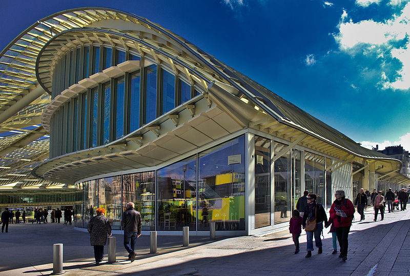
Français : http://www.parisleshalles.fr/le-projet/la-canopee-0027
Une continuité entre le dessus et le dessous La partie émergée des Halles (pavillons Willerval) sera remplacée par un édifice aux formes courbes d’inspiration végétale : La Canopée – un terme habituellement utilisé pour désigner la partie supérieure des forêts, en contact direct avec l’atmosphère libre et les rayons du soleil. Une animation continuelle sous un abri urbain de plein air Telle une immense feuille translucide ondoyant à la hauteur de la cime des arbres du jardin, la Canopée abritera deux bâtiments pour des équipements publics et des commerces. Ces deux ailes seront disposées autour d’un patio qui deviendra le nouveau cœur des Halles. Espace public à l’abri des intempéries, le patio sera un lieu à vivre pour tous ceux qui fréquentent Les Halles. Hall extérieur pour les équipements culturels et les boutiques, il constituera un formidable cadre scénique pour accueillir des manifestations culturelles ou commerciales. |
| Date | |
| Source | Self-photographed |
| Author | Jmdigne |
| Camera location | | View this and other nearby images on: OpenStreetMap |
|---|
Licensing
edit
- You are free:
- to share – to copy, distribute and transmit the work
- to remix – to adapt the work
- Under the following conditions:
- attribution – You must give appropriate credit, provide a link to the license, and indicate if changes were made. You may do so in any reasonable manner, but not in any way that suggests the licensor endorses you or your use.
- share alike – If you remix, transform, or build upon the material, you must distribute your contributions under the same or compatible license as the original.
File history
Click on a date/time to view the file as it appeared at that time.
| Date/Time | Thumbnail | Dimensions | User | Comment | |
|---|---|---|---|---|---|
| current | 06:34, 19 April 2016 | | 5,153 × 3,465 (20.87 MB) | Jmdigne (talk | contribs) | User created page with UploadWizard |
You cannot overwrite this file.
File usage on Commons
There are no pages that use this file.
File usage on other wikis
The following other wikis use this file:
- Usage on de.wikipedia.org
- Usage on ja.wikipedia.org