File:Paris europe train map de.png
Size of this preview: 552 × 600 pixels. Other resolutions: 221 × 240 pixels | 442 × 480 pixels | 707 × 768 pixels | 1,024 × 1,113 pixels.
Original file (1,024 × 1,113 pixels, file size: 63 KB, MIME type: image/png)
Captions
Captions
Add a one-line explanation of what this file represents
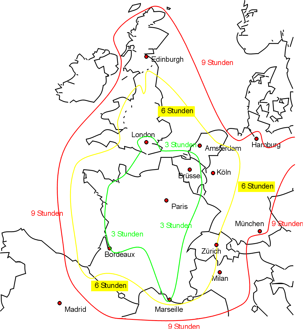
Reisezeiten für Züge von Paris.
Sketch map showing approximate journey times on the train from Paris to the rest of western Europe, with text in German (my apologies for any translation errors).
Drawn by Bob Tubbs, based on queries to the SNCF website.
Original English version at Image:paris_europe_train_map.png
| I, the copyright holder of this work, release this work into the public domain. This applies worldwide. In some countries this may not be legally possible; if so: I grant anyone the right to use this work for any purpose, without any conditions, unless such conditions are required by law. |
File history
Click on a date/time to view the file as it appeared at that time.
| Date/Time | Thumbnail | Dimensions | User | Comment | |
|---|---|---|---|---|---|
| current | 20:26, 29 July 2006 | | 1,024 × 1,113 (63 KB) | Rnt20 (talk | contribs) | |
| 20:12, 31 May 2005 |  | 1,024 × 1,113 (62 KB) | Rnt20 (talk | contribs) | Sketch map showing approximate journey times on the train from Paris to the rest of western Europe, with text in German (my apologies for any translation errors). Drawn by Bob Tubbs, based on queries to the SNCF website. Original English version at [[Im | |
| 20:12, 31 May 2005 |  | 1,024 × 1,113 (62 KB) | Rnt20 (talk | contribs) | Sketch map showing approximate journey times on the train from Paris to the rest of western Europe, with text in German (my apologies for any translation errors). Drawn by Bob Tubbs, based on queries to the SNCF website. Original English version at [[Im |
You cannot overwrite this file.
File usage on Commons
There are no pages that use this file.
File usage on other wikis
The following other wikis use this file:
- Usage on de.wikipedia.org
- Usage on uk.wikipedia.org