File:Parish House, St. John's Lutheran Church, Lancaster, New York - 20230112.jpg

Size of this preview: 800 × 533 pixels. Other resolutions: 320 × 213 pixels | 640 × 427 pixels | 1,024 × 683 pixels | 1,280 × 853 pixels | 2,560 × 1,707 pixels | 3,669 × 2,446 pixels.
Original file (3,669 × 2,446 pixels, file size: 5.62 MB, MIME type: image/jpeg)
Captions
Captions
Add a one-line explanation of what this file represents
Summary
edit
| Description |
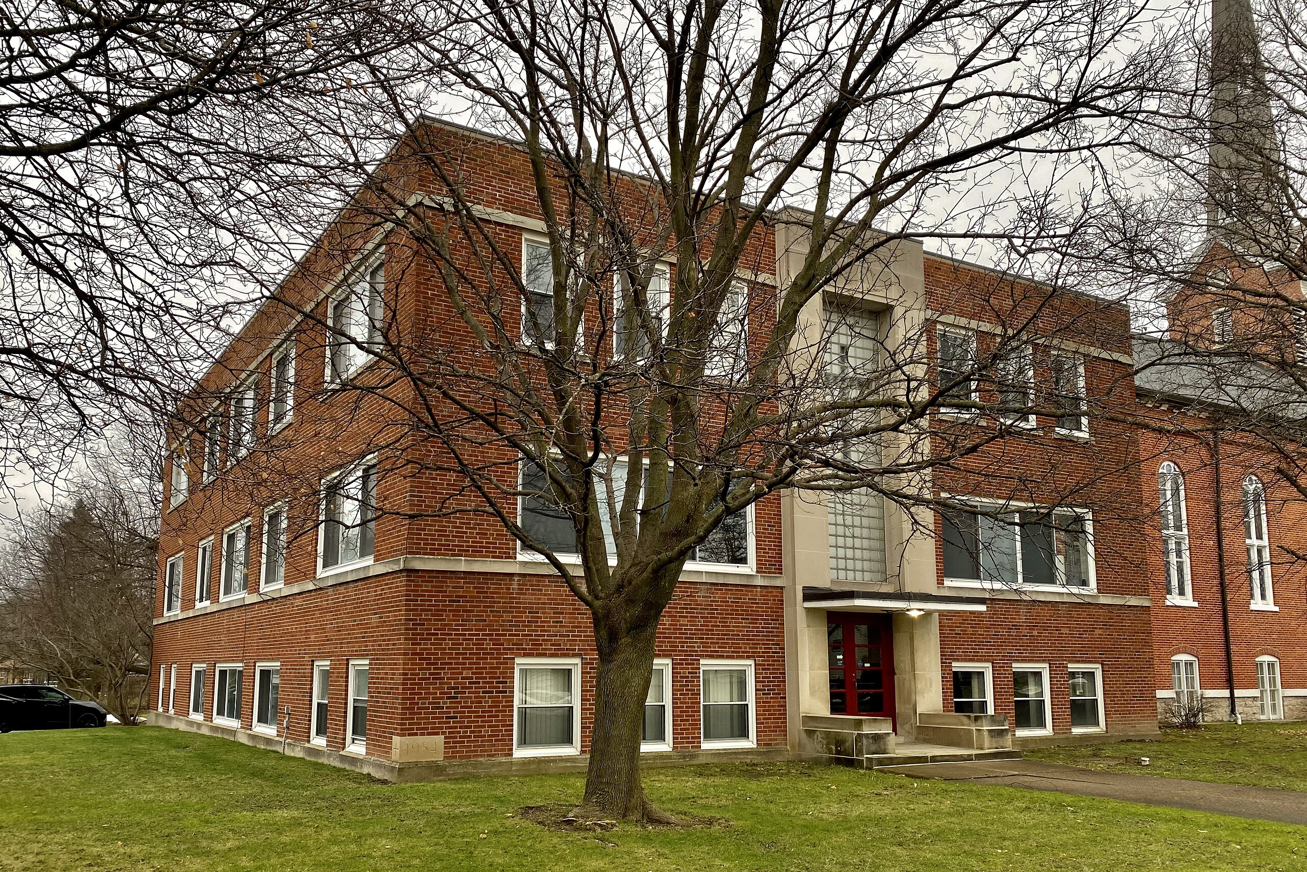
English: As seen in January 2023, the parish house of St. John's Lutheran Church stands at the corner of Pleasant Avenue and School Street in the village of Lancaster, New York. Built in 1955 to a design by the Buffalo-based architectural firm of Shelgren & Whitman, this three-story brick building was the centerpiece of a $235,000 construction program undertaken by the church as suburbanization led to meteoric growth in the congregation, the other improvements being a full remodel of the original 1877 building and a new parsonage. Here we see the Modernist style fully embraced in a way that the firm was not yet daring to try in their designs for churches themselves, for which more typically they would continue to utilize the Colonial Revival or Late Gothic until well into the 1960s. It's a flat-roofed structure with an exterior faced in red brick and accented by light-colored stone trim, which comes in the form of projecting belt courses above the first and third stories as well as a monumentally-scaled surround on which the main façade is centered, framing both the entrance and a two-story window of frosted glass blocks. Throughout the design, sleek lines, right angles, and simplified forms abound in accordance with the style. Ground was broken on the building, which contained Sunday school classrooms, a fellowship hall, fireside lounge, full-size modern kitchen, and administrative offices, in September 1954, and work preceded briskly: rededication ceremonies in August of the following year were emceed by the Rev. Ernest C. French, president of the Western Conference of the United Lutheran Synod of New York and New England. |
| Date | |
| Source | Own work |
| Author | Andre Carrotflower |
| Camera location | | View this and other nearby images on: OpenStreetMap |
|---|
Licensing
edit
I, the copyright holder of this work, hereby publish it under the following license:
This file is licensed under the Creative Commons Attribution-Share Alike 4.0 International license.
- You are free:
- to share – to copy, distribute and transmit the work
- to remix – to adapt the work
- Under the following conditions:
- attribution – You must give appropriate credit, provide a link to the license, and indicate if changes were made. You may do so in any reasonable manner, but not in any way that suggests the licensor endorses you or your use.
- share alike – If you remix, transform, or build upon the material, you must distribute your contributions under the same or compatible license as the original.
File history
Click on a date/time to view the file as it appeared at that time.
| Date/Time | Thumbnail | Dimensions | User | Comment | |
|---|---|---|---|---|---|
| current | 18:13, 29 January 2023 | | 3,669 × 2,446 (5.62 MB) | Andre Carrotflower (talk | contribs) | Uploaded own work with UploadWizard |
You cannot overwrite this file.
File usage on Commons
There are no pages that use this file.