File:Parque Estadual da Guarita 05.jpg
Size of this preview: 800 × 494 pixels. Other resolutions: 320 × 198 pixels | 640 × 395 pixels | 1,024 × 633 pixels | 1,280 × 791 pixels | 1,800 × 1,112 pixels.
Original file (1,800 × 1,112 pixels, file size: 1.19 MB, MIME type: image/jpeg)
Captions
Captions
Add a one-line explanation of what this file represents
Summary
edit
| Description |
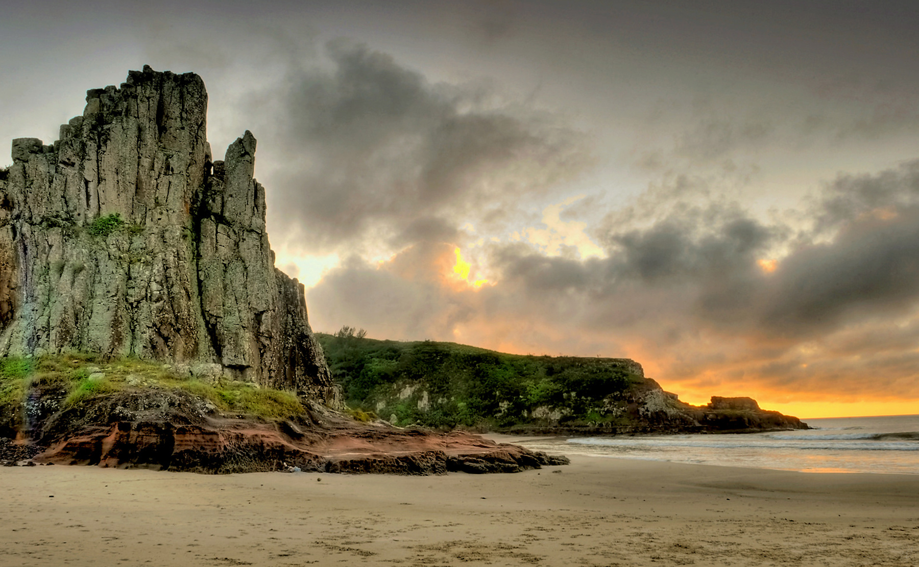
Português: O Parque Estadual José Lutzenberger, mais conhecido como Parque da Guarita, é uma Unidade de Conservação brasileira situada na região sul, no Estado do Rio Grande do Sul, no município de Torres. Seu nome homenageia o ambientalista gaúcho José Lutzenberger, que foi um dos maiores incentivadores da sua criação.1
O Parque da Guarita localiza-se em uma área que correspondia a um complexo turístico. É constituído essencialmente por ecossistema costeiro, contando com a praia da Guarita, porém na sua implantação foram criadas áreas reproduzindo outros ecossistemas da região. Possui cerca de 350 hectares e sofre há 5 décadas com a falta de gerenciamento. Somente em janeiro de 2002 houve projeto privado em parceria com a municipalidade para revitalizá-lo e dar-lhe funções de educação ambiental e turísticas. Com o advento do furacão Catarina o projeto foi desativado e nos dias de hoje cogita-se terceirização do mesmo. Existem pesquisas sobre sua biota e um dos levantamentos mais completos foi realizado pela designer ambiental Cláudia Costa, estando em fase de acabamento para publicação. |
| Date | |
| Source | Own work |
| Author | Germano Roberto Schüür |
| Camera location | | View this and other nearby images on: OpenStreetMap |
|---|
Licensing
edit
I, the copyright holder of this work, hereby publish it under the following license:
This file is licensed under the Creative Commons Attribution-Share Alike 3.0 Unported license.
- You are free:
- to share – to copy, distribute and transmit the work
- to remix – to adapt the work
- Under the following conditions:
- attribution – You must give appropriate credit, provide a link to the license, and indicate if changes were made. You may do so in any reasonable manner, but not in any way that suggests the licensor endorses you or your use.
- share alike – If you remix, transform, or build upon the material, you must distribute your contributions under the same or compatible license as the original.
This image was uploaded as part of Wiki Loves Earth 2015.
|
 |
File history
Click on a date/time to view the file as it appeared at that time.
| Date/Time | Thumbnail | Dimensions | User | Comment | |
|---|---|---|---|---|---|
| current | 21:45, 22 May 2015 | | 1,800 × 1,112 (1.19 MB) | Germano Roberto Schüür (talk | contribs) | User created page with UploadWizard |
You cannot overwrite this file.
File usage on Commons
There are no pages that use this file.