File:Parroquia Santa Rita.PNG
Size of this preview: 800 × 555 pixels. Other resolutions: 320 × 222 pixels | 640 × 444 pixels | 1,024 × 711 pixels | 1,278 × 887 pixels.
Original file (1,278 × 887 pixels, file size: 110 KB, MIME type: image/png)
Captions
Captions
Add a one-line explanation of what this file represents
Summary
edit
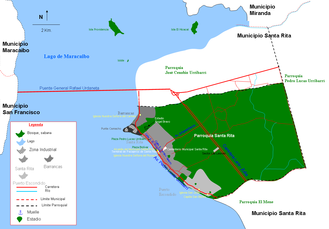
| Description |
Español: Mapa de la Parroquia Santa Rita, Municipio Santa Rita, Estado Zulia, Venezuela |
| Date | |
| Source | Own work |
| Author | Andrés González |
Licensing
edit
| I, the copyright holder of this work, release this work into the public domain. This applies worldwide. In some countries this may not be legally possible; if so: I grant anyone the right to use this work for any purpose, without any conditions, unless such conditions are required by law. |
File history
Click on a date/time to view the file as it appeared at that time.
| Date/Time | Thumbnail | Dimensions | User | Comment | |
|---|---|---|---|---|---|
| current | 12:32, 26 July 2013 | | 1,278 × 887 (110 KB) | Andrés González (talk | contribs) | Corrigiendo iglesia y leyenda |
| 12:27, 13 March 2012 |  | 1,266 × 884 (110 KB) | Andrés González (talk | contribs) | Corrigiendo límites de la parroquia | |
| 18:50, 25 February 2012 |  | 1,264 × 878 (113 KB) | Andrés González (talk | contribs) | Mapa mejorado con mas detalles, muelles, carreteras, puntos de referencia, leyenda y escala | |
| 15:37, 16 March 2009 |  | 557 × 350 (13 KB) | Andrés González (talk | contribs) | {{Information |Description={{es|1=Mapa de la Parroquia Santa Rita, Municipio Santa Rita, Estado Zulia, Venezuela}} |Source=Own work by uploader |Author=Andrés González |Date=16-3-2009 |Permission= |other_versions= }} <!--{{Im |
You cannot overwrite this file.
File usage on Commons
There are no pages that use this file.
File usage on other wikis
The following other wikis use this file:
- Usage on es.wikipedia.org