File:Path into the Lairig Ghru - geograph.org.uk - 778414.jpg

Size of this preview: 800 × 538 pixels. Other resolutions: 320 × 215 pixels | 640 × 430 pixels | 1,024 × 688 pixels.
Original file (1,024 × 688 pixels, file size: 948 KB, MIME type: image/jpeg)
Captions
Captions
Add a one-line explanation of what this file represents
Summary
edit
| Description |
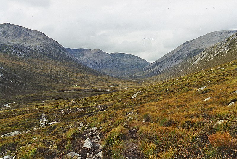
English: Path into the Lairig Ghru As the path begins a slight descent to the floor of Glen Dee, views of the Lairig Ghru open up. Cairn Toul is on the left with Braeriach behind, and Ben Macdui on the right. The tiny dot of Corrour Bothy can be seen left of centre. |
| Date | |
| Source | From geograph.org.uk |
| Author | Nigel Brown |
| Attribution (required by the license) | Nigel Brown / Path into the Lairig Ghru / |
| Camera location | | View this and other nearby images on: OpenStreetMap |
|---|
_heading:337.00&language=en)
| Object location | | View this and other nearby images on: OpenStreetMap |
|---|
_heading:337.00&language=en)
Licensing
edit

|
This image was taken from the Geograph project collection. See this photograph's page on the Geograph website for the photographer's contact details. The copyright on this image is owned by Nigel Brown and is licensed for reuse under the Creative Commons Attribution-ShareAlike 2.0 license.
|
This file is licensed under the Creative Commons Attribution-Share Alike 2.0 Generic license.
Attribution: Nigel Brown
- You are free:
- to share – to copy, distribute and transmit the work
- to remix – to adapt the work
- Under the following conditions:
- attribution – You must give appropriate credit, provide a link to the license, and indicate if changes were made. You may do so in any reasonable manner, but not in any way that suggests the licensor endorses you or your use.
- share alike – If you remix, transform, or build upon the material, you must distribute your contributions under the same or compatible license as the original.
File history
Click on a date/time to view the file as it appeared at that time.
| Date/Time | Thumbnail | Dimensions | User | Comment | |
|---|---|---|---|---|---|
| current | 16:42, 16 May 2020 | | 1,024 × 688 (948 KB) | Geograph Update Bot (talk | contribs) | Higher-resolution version from Geograph. |
| 22:38, 19 February 2011 |  | 640 × 430 (83 KB) | GeographBot (talk | contribs) | == {{int:filedesc}} == {{Information |description={{en|1=Path into the Lairig Ghru As the path begins a slight descent to the floor of Glen Dee, views of the Lairig Ghru open up. Cairn Toul is on the left with Braeriach behind, and Ben Macdui on the right |
You cannot overwrite this file.
File usage on Commons
There are no pages that use this file.