File:Patrington Channel along the Humber estuary (geograph 5562426).jpg
Patrington_Channel_along_the_Humber_estuary_(geograph_5562426).jpg (800 × 514 pixels, file size: 87 KB, MIME type: image/jpeg)
Captions
Captions
Summary
edit.jpg&action=edit§ion=1)
| Description |
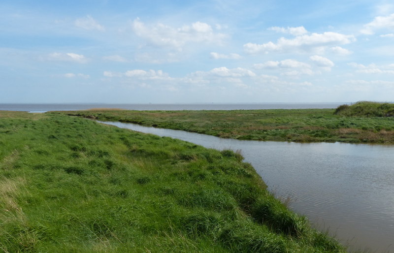
English: Patrington Channel along the Humber estuary, Welwick, East Riding of Yorkshire, England. The Humber is a large tidal estuary on the east coast of Northern England. It is formed at Trent Falls, Faxfleet, by the confluence of the tidal rivers Ouse and Trent. From here to the North Sea, it forms part of the boundary between the East Riding of Yorkshire on the north bank and North Lincolnshire and North East Lincolnshire on the south bank. Although the Humber is an estuary from the point at which it is formed, many maps show it as the River Humber. Below Trent Falls, the Humber passes the confluence of the River Ancholme on the south shore; between North Ferriby and South Ferriby and under the Humber Bridge; between Barton-upon-Humber on the south bank and Kingston upon Hull on the north bank (where the River Hull joins), then meets the North Sea between Cleethorpes on the Lincolnshire side and the long and thin (but rapidly changing) headland of Spurn Head to the north.
Ports on the Humber include Kingston upon Hull (better known as simply Hull), Grimsby, Immingham, New Holland and Killingholme. The estuary is navigable here for the largest of deep-sea vessels.
|
| Date | |
| Source | From geograph.org.uk |
| Author | Mat Fascione |
| Permission (Reusing this file) |
Creative Commons Attribution Share-alike license 2.0 |
| Attribution (required by the license) | Mat Fascione / Patrington Channel along the Humber estuary / |
| Camera location | | View this and other nearby images on: OpenStreetMap |
|---|
.jpg¶ms=053.646182_N_0000.016768_E_globe:Earth_type:camera_source:geograph-osgb36(TA33411852)_heading:135.00&language=en)
| Object location | | View this and other nearby images on: OpenStreetMap |
|---|
.jpg¶ms=053.646180_N_0000.016770_E_globe:Earth_class:object_type:object_source:geograph-osgb36(TA33411852)_heading:135.00&language=en)
Licensing
edit.jpg&action=edit§ion=2)

|
This image was taken from the Geograph project collection. See this photograph's page on the Geograph website for the photographer's contact details. The copyright on this image is owned by Mat Fascione and is licensed for reuse under the Creative Commons Attribution-ShareAlike 2.0 license.
|
- You are free:
- to share – to copy, distribute and transmit the work
- to remix – to adapt the work
- Under the following conditions:
- attribution – You must give appropriate credit, provide a link to the license, and indicate if changes were made. You may do so in any reasonable manner, but not in any way that suggests the licensor endorses you or your use.
- share alike – If you remix, transform, or build upon the material, you must distribute your contributions under the same or compatible license as the original.
File history
Click on a date/time to view the file as it appeared at that time.
| Date/Time | Thumbnail | Dimensions | User | Comment | |
|---|---|---|---|---|---|
| current | 11:37, 1 February 2022 | | 800 × 514 (87 KB) | Keith D (talk | contribs) | == {{int:filedesc}} == {{Information |Description={{en|1=Patrington Channel along the Humber estuary, Welwick, East Riding of Yorkshire, England.<br />The Humber is a large tidal estuary on the east coast of Northern England. It is formed at Trent Falls, Faxfleet, by the confluence of the tidal rivers Ouse and Trent. From here to the North Sea, it forms part of the boundary between the East Riding of Yorkshire on the north bank and North Lincol... |
You cannot overwrite this file.
File usage on Commons
There are no pages that use this file.
.jpg&oldid=716098484)