File:Pawłowice (gmina) location map.png

Original file (1,673 × 2,370 pixels, file size: 733 KB, MIME type: image/png)
Captions
Captions
Summary
edit_location_map.png&action=edit§ion=1)
| Description |
English: Location map |
| Date | |
| Source | Own work |
| Author | Smat |
| Description |
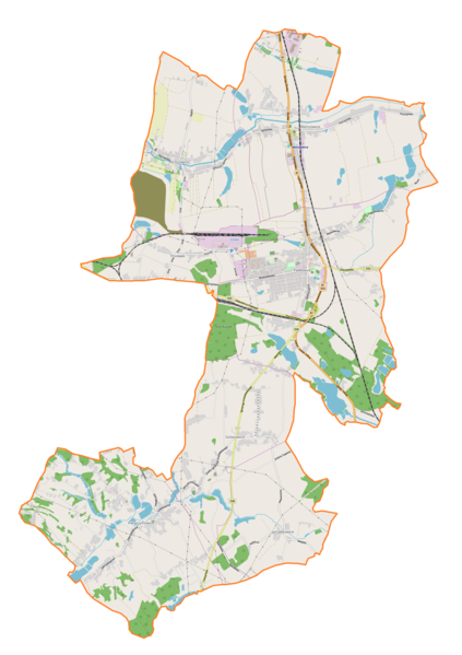
Polski: Mapa gminy Pawłowice, Polska
English: Map of Pawłowice (gmina), Poland |
|||||||||
| Date | ||||||||||
| Source | You may find a page on the OpenStreetMap wiki page for Pawłowice (gmina) | |||||||||
| Creator |
OpenStreetMap contributors OpenStreetMap contributors |
|||||||||
| Permission (Reusing this file) |
OpenStreetMap data is available under the Open Database License (details). Map tiles are licensed under the Creative Commons Attribution-ShareAlike 2.0 license (CC-BY-SA 2.0).
This file is licensed under the Creative Commons Attribution-Share Alike 2.0 Generic license.
|
|||||||||
| Geotemporal data | ||||||||||
| Bounding box |
|
|||||||||
| Georeferencing | If inappropriate please set warp_status = skip to hide. | |||||||||
Licensing
edit_location_map.png&action=edit§ion=2)
| This work contains information from OpenStreetMap, which is made available under the Open Database License (ODbL).
The ODbL does not require any particular license for maps produced from ODbL data. Prior to 1 August 2020, map tiles produced by the OpenStreetMap Foundation were licensed under the CC-BY-SA-2.0 license. Maps produced by other people may be subject to other licences. |
File history
Click on a date/time to view the file as it appeared at that time.
| Date/Time | Thumbnail | Dimensions | User | Comment | |
|---|---|---|---|---|---|
| current | 16:23, 30 October 2018 | | 1,673 × 2,370 (733 KB) | Smat (talk | contribs) | User created page with UploadWizard |
You cannot overwrite this file.
File usage on Commons
There are no pages that use this file.
File usage on other wikis
The following other wikis use this file:
- Usage on de.wikipedia.org
- Usage on pl.wikipedia.org
- Golasowice
- Warszowice
- Jarząbkowice (województwo śląskie)
- Krzyżowice (województwo śląskie)
- Pielgrzymowice (województwo śląskie)
- Pniówek (województwo śląskie)
- Pawłowice (powiat pszczyński)
- Kopalnia Węgla Kamiennego „Pniówek”
- Parafia Narodzenia Najświętszej Maryi Panny w Golasowicach
- Parafia św. Michała Archanioła w Krzyżowicach
- Parafia św. Katarzyny w Pielgrzymowicach
- Parafia św. Mikołaja w Warszowicach
- Parafia św. Jana Chrzciciela w Pawłowicach Śląskich
- Parafia Podwyższenia Krzyża Świętego w Pawłowicach Śląskich
- Szkoła Podstawowa im. Karola Miarki w Pielgrzymowicach
- Pawłowice Śląskie
- Warszowice (stacja kolejowa)
- Kościół św. Katarzyny w Pielgrzymowicach
- Parafia Ewangelicko-Augsburska w Golasowicach
- Parafia Ewangelicko-Augsburska w Warszowicach
- Kościół św. Jana Chrzciciela w Pawłowicach (powiat pszczyński)
- Kościół św. Michała Archanioła w Krzyżowicach
- Pawłowice Górnicze
- Moduł:Mapa/dane/Pawłowice (gmina)
- Pawłowice Śląskie Centrum
- Usage on pl.wikibooks.org
_location_map.png&oldid=706465027)