File:Pereje Albergue.jpg
Size of this preview: 800 × 600 pixels. Other resolutions: 320 × 240 pixels | 640 × 480 pixels | 1,024 × 768 pixels | 1,280 × 960 pixels.
Original file (1,280 × 960 pixels, file size: 280 KB, MIME type: image/jpeg)
Captions
Captions
Add a one-line explanation of what this file represents
Summary
edit
| Description |
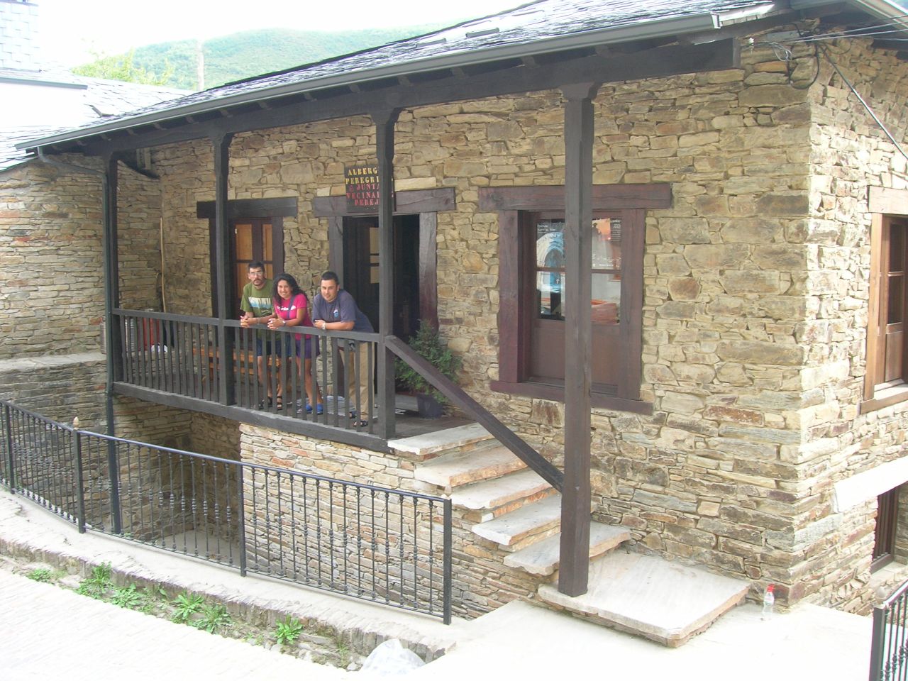
Albergue de peregrinos de Pereje, en la Sierra de Los Ancares, que todavía conserva el trazado medieval del Camino en su Calle Mayor. Necesitas el programa Google Earth |
| Date | |
| Source | Pereje |
| Author | José Antonio Gil Martínez from Vigo, Spain |
| Camera location | | View this and other nearby images on: OpenStreetMap |
|---|
Licensing
edit
This file is licensed under the Creative Commons Attribution 2.0 Generic license.
- You are free:
- to share – to copy, distribute and transmit the work
- to remix – to adapt the work
- Under the following conditions:
- attribution – You must give appropriate credit, provide a link to the license, and indicate if changes were made. You may do so in any reasonable manner, but not in any way that suggests the licensor endorses you or your use.
| This image was originally posted to Flickr by FreeCat at https://www.flickr.com/photos/17364971@N00/65912564. It was reviewed on 8 July 2008 by FlickreviewR and was confirmed to be licensed under the terms of the cc-by-2.0. |
File history
Click on a date/time to view the file as it appeared at that time.
| Date/Time | Thumbnail | Dimensions | User | Comment | |
|---|---|---|---|---|---|
| current | 12:30, 8 July 2008 | | 1,280 × 960 (280 KB) | Vicky petereit (talk | contribs) | {{Information |Description= Albergue de peregrinos de este pequeño y tranquilo pueblo de la Sierra de Los Ancares, que todavía conserva el trazado medieval del Camino en su Calle Mayor. [http://www.roblog.com/flickrfly.kml Vuela hasta esta localizació |
You cannot overwrite this file.
File usage on Commons
The following page uses this file:
- File:Pereje (65912564).jpg (file redirect)
.jpg&redirect=no)
File usage on other wikis
The following other wikis use this file: