File:PeruRail ALCo DL535B Poroy - Ollantaytambo.jpg

Size of this preview: 800 × 494 pixels. Other resolutions: 320 × 198 pixels | 640 × 395 pixels | 1,024 × 632 pixels | 1,280 × 790 pixels | 2,560 × 1,580 pixels | 6,490 × 4,006 pixels.
Original file (6,490 × 4,006 pixels, file size: 6.55 MB, MIME type: image/jpeg)
Captions
Captions
Add a one-line explanation of what this file represents
Summary
edit
| Description |
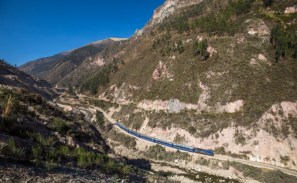
English: PeruRail's 353 hauls Vistadome 203 from Poroy (outside Cusco) to Ollantaytambo, and later to Aguas Calientes. The train has just passed the switchback near Huarocondo, still visible in the background.
Deutsch: ALCo DL535B nr. 353 von PeruRail zieht Vistadome 203 von Poroy (ausserhalb Cusco) nach Ollantaytambo, und später weiter nach Aguas Calientes. Der Zug hat soeben die Spitzkehre bei Huarocondo passiert (im Hintergrund sichtbar). |
| Date | |
| Source | Own work, also available at https://bahnbilder.ch/picture/27248 |
| Author | Kabelleger / David Gubler |
| Camera location | | View this and other nearby images on: OpenStreetMap |
|---|
Licensing
edit
I, the copyright holder of this work, hereby publish it under the following license:
This file is licensed under the Creative Commons Attribution-Share Alike 4.0 International license.
- You are free:
- to share – to copy, distribute and transmit the work
- to remix – to adapt the work
- Under the following conditions:
- attribution – You must give appropriate credit, provide a link to the license, and indicate if changes were made. You may do so in any reasonable manner, but not in any way that suggests the licensor endorses you or your use.
- share alike – If you remix, transform, or build upon the material, you must distribute your contributions under the same or compatible license as the original.
File history
Click on a date/time to view the file as it appeared at that time.
| Date/Time | Thumbnail | Dimensions | User | Comment | |
|---|---|---|---|---|---|
| current | 21:06, 14 August 2017 | | 6,490 × 4,006 (6.55 MB) | Kabelleger (talk | contribs) | User created page with UploadWizard |
You cannot overwrite this file.
File usage on Commons
The following 2 pages use this file:
File usage on other wikis
The following other wikis use this file:
- Usage on ceb.wikipedia.org
- Usage on es.wikipedia.org
- Usage on no.wikipedia.org
- Usage on www.wikidata.org