File:Peta Kota Atambua.png
Size of this preview: 655 × 599 pixels. Other resolutions: 262 × 240 pixels | 525 × 480 pixels | 840 × 768 pixels | 1,119 × 1,024 pixels | 1,315 × 1,203 pixels.
Original file (1,315 × 1,203 pixels, file size: 300 KB, MIME type: image/png)
Captions
Captions
Add a one-line explanation of what this file represents
Summary
edit
| Description |
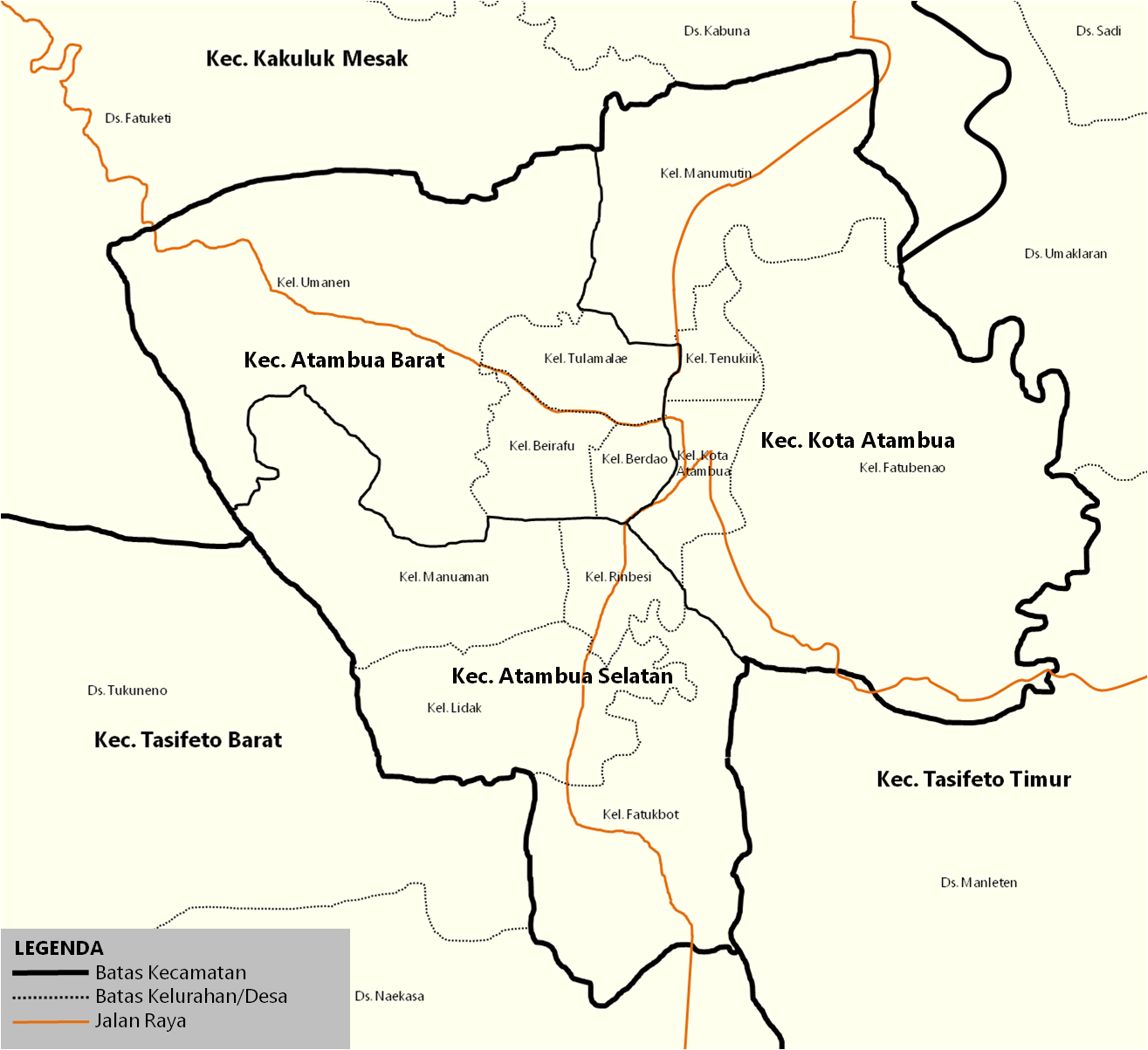
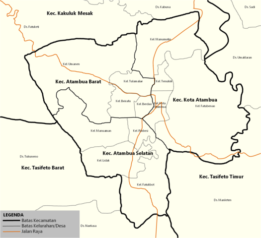
English: Map of the districts inside town of Atambua. Indonesia |
| Source | id.wikipedia.org |
| Author | Jolly Frankle |
Licensing
edit
| I, the copyright holder of this work, release this work into the public domain. This applies worldwide. In some countries this may not be legally possible; if so: I grant anyone the right to use this work for any purpose, without any conditions, unless such conditions are required by law. |
Original upload log
edit
The original description page was here. All following user names refer to id.wikipedia.
- 2017-07-14 09:37 JollyFrankle 1315×1203× (307479 bytes) Penambahan Legenda
- 2017-07-14 09:31 JollyFrankle 1315×1203× (306739 bytes) Nama Kelurahan, Jalan Raya, Kecamatan Tetangga
- 2017-07-11 03:24 JollyFrankle 1275×1190× (33933 bytes)
File history
Click on a date/time to view the file as it appeared at that time.
| Date/Time | Thumbnail | Dimensions | User | Comment | |
|---|---|---|---|---|---|
| current | 05:20, 20 December 2018 | | 1,315 × 1,203 (300 KB) | JollyFrankle (talk | contribs) | {{Information |description ={{en|1=Map of the districts inside town of Atambua. Indonesia}} |date = |source =id.wikipedia.org |author =Jolly Frankle }} == {{Original upload log}} == {{original description page|id.wikipedia|Peta_Kota_Atambua.png}} * 2017-07-14 09:37 JollyFrankle 1315×1203× (307479 bytes) ''<nowiki>Penambahan Legenda</nowiki>'' * 2017-07-14 09:31 JollyFrankle 1315×1203× (306739 bytes) ''<nowiki>Nama K... |
You cannot overwrite this file.
File usage on Commons
The following page uses this file:
File usage on other wikis
The following other wikis use this file:
- Usage on ar.wikipedia.org
- Usage on ban.wikipedia.org
- Usage on ceb.wikipedia.org
- Usage on de.wikipedia.org
- Usage on en.wikivoyage.org
- Usage on id.wikipedia.org
- Kota Atambua, Belu
- Templat:Kota Atambua
- Atambua Selatan, Belu
- Atambua, Atambua, Belu
- Fatubenao, Atambua, Belu
- Manumutin, Atambua, Belu
- Tenukiik, Atambua, Belu
- SMA Negeri 1 Atambua
- Bandar Udara A. A. Bere Tallo
- Atambua
- Transportasi di Kota Atambua
- HUT Kota Atambua
- SMA Katolik Suria Atambua
- Kategori:Kota Atambua
- Sejarah Kota Atambua
- Usage on nl.wikipedia.org
- Usage on pl.wikipedia.org
- Usage on www.wikidata.org