File:Peterborough UK local election 2021 map.svg

Size of this PNG preview of this SVG file: 800 × 477 pixels. Other resolutions: 320 × 191 pixels | 640 × 382 pixels | 1,024 × 611 pixels | 1,280 × 764 pixels | 2,560 × 1,527 pixels | 1,425 × 850 pixels.
Original file (SVG file, nominally 1,425 × 850 pixels, file size: 473 KB)
Captions
Captions
Add a one-line explanation of what this file represents
Summary
edit
| Description |
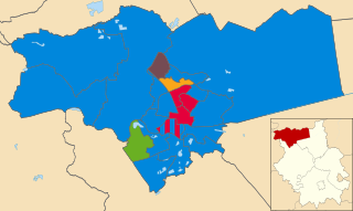
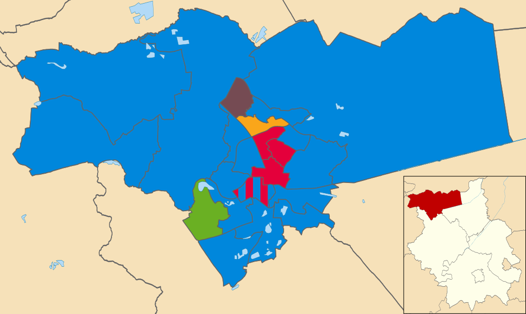
English: Map of Peterborough, Cambridgeshire showing the results of the 2021 City Council election |
| Date | |
| Source |
This file was derived from: Peterborough UK ward map 2016 (blank).svg: |
| Author | Nilfanion, created using Ordnance Survey data; derivative work: dummelaksen |
.svg)
Licensing
edit
This file is licensed under the Creative Commons Attribution-Share Alike 4.0 International license.
- You are free:
- to share – to copy, distribute and transmit the work
- to remix – to adapt the work
- Under the following conditions:
- attribution – You must give appropriate credit, provide a link to the license, and indicate if changes were made. You may do so in any reasonable manner, but not in any way that suggests the licensor endorses you or your use.
- share alike – If you remix, transform, or build upon the material, you must distribute your contributions under the same or compatible license as the original.
File history
Click on a date/time to view the file as it appeared at that time.
| Date/Time | Thumbnail | Dimensions | User | Comment | |
|---|---|---|---|---|---|
| current | 12:18, 16 July 2021 | | 1,425 × 850 (473 KB) | Dummelaksen (talk | contribs) | Uploaded a work by Nilfanion, created using Ordnance Survey data; derivative work: dummelaksen from {{Derived from|Peterborough UK ward map 2016 (blank).svg|display=50}} with UploadWizard |
You cannot overwrite this file.
File usage on Commons
The following page uses this file:
File usage on other wikis
The following other wikis use this file:
- Usage on en.wikipedia.org
- Usage on www.wikidata.org