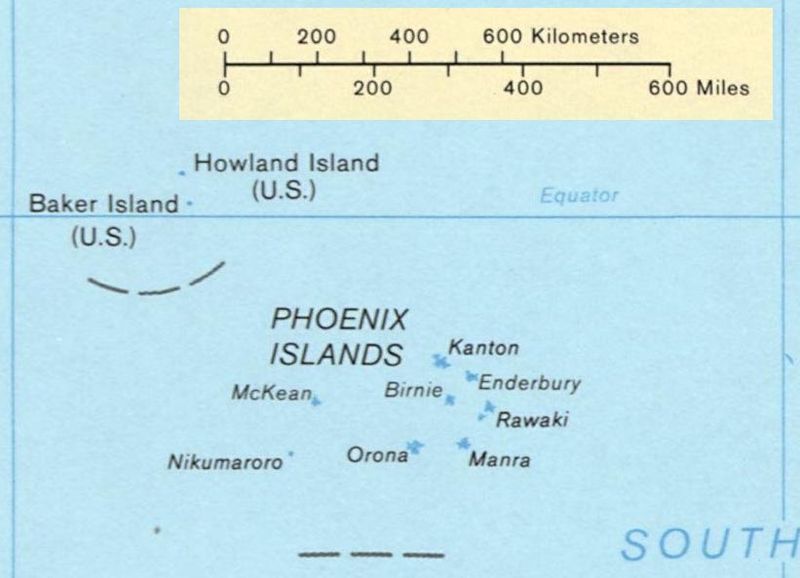
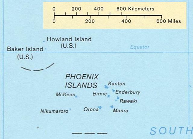
File:Phoenix Islands Kiribati.jpg

Size of this preview: 800 × 578 pixels. Other resolutions: 320 × 231 pixels | 640 × 462 pixels | 821 × 593 pixels.
Original file (821 × 593 pixels, file size: 74 KB, MIME type: image/jpeg)
Captions
Captions
Add a one-line explanation of what this file represents
| Description |
Deutsch: Karte der Phoenixinseln, Kiribati
English: Map of the Phoenix Islands, Kiribati
Español: Mapa de las Islas Fénix, Kiribati |
|||
| Source | US government | |||
| Author | US Library of Congress | |||
| Permission (Reusing this file) |
|
|||
| Other versions | Image:Kiribati map LOC.jpg, entire map |

File history
Click on a date/time to view the file as it appeared at that time.
| Date/Time | Thumbnail | Dimensions | User | Comment | |
|---|---|---|---|---|---|
| current | 00:23, 4 February 2008 | | 821 × 593 (74 KB) | Indolences (talk | contribs) | {{Information |Description={{en|Map of the Phoenix Islands, Kiribati}} {{es|Mapa de las Islas Phoenix, Kiribati}} |Source= US government |Date= |Author= US Library of Congress |Permission={{PD-USgov}} |other_ver |
You cannot overwrite this file.
File usage on Commons
There are no pages that use this file.
File usage on other wikis
The following other wikis use this file:
- Usage on ca.wikipedia.org
- Usage on hr.wikipedia.org