File:Phoenix Shoal map.png
Size of this preview: 781 × 600 pixels. Other resolutions: 313 × 240 pixels | 625 × 480 pixels | 1,000 × 768 pixels | 1,280 × 983 pixels | 2,560 × 1,965 pixels | 7,793 × 5,983 pixels.
Original file (7,793 × 5,983 pixels, file size: 2.22 MB, MIME type: image/png)
Captions
Captions
Add a one-line explanation of what this file represents
Summary
edit
| Description |
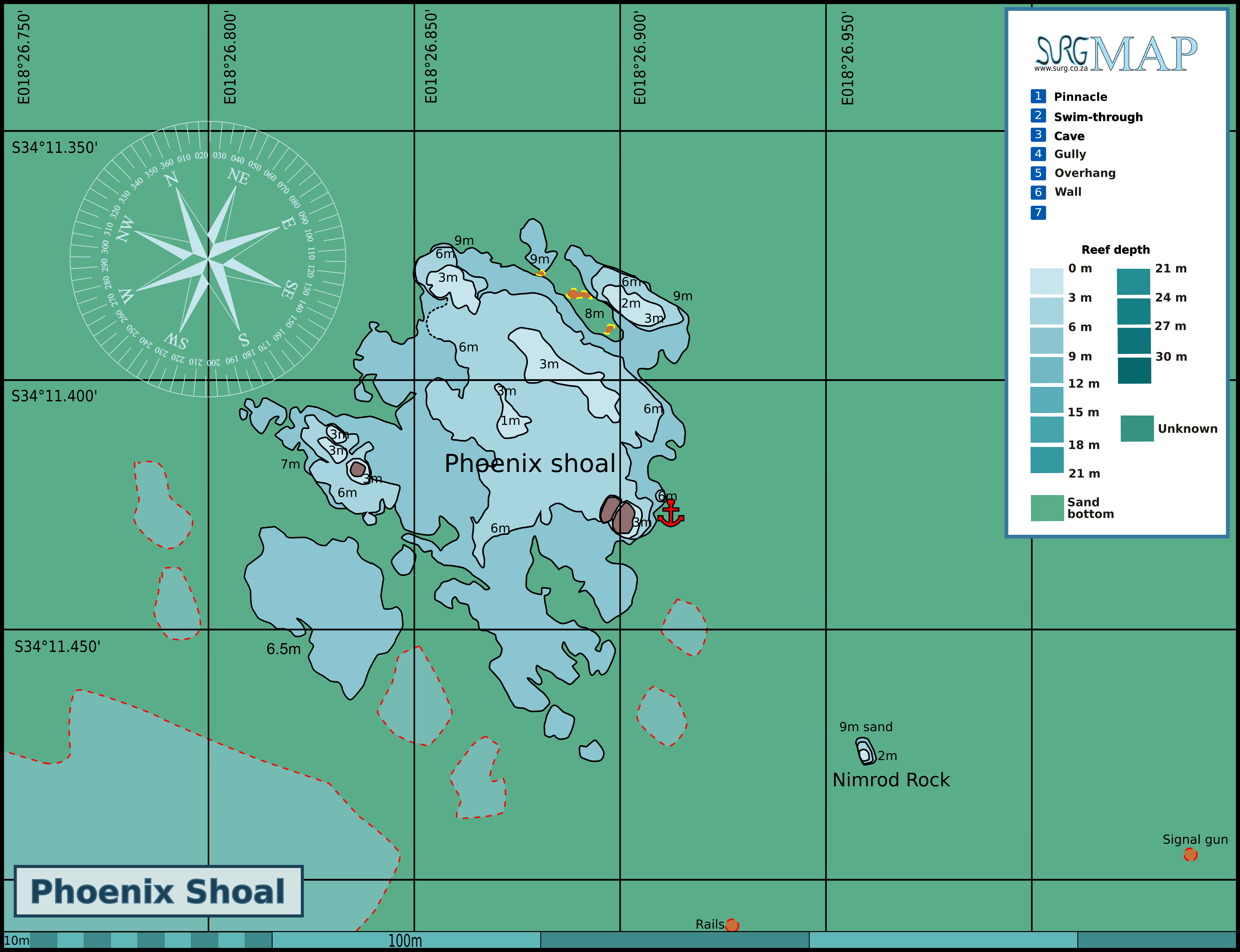
English: Map of the dive site at Phoenix shoal in Simon's Bay |
| Date | |
| Source | Own work |
| Author | Pbsouthwood |
Licensing
edit
I, the copyright holder of this work, hereby publish it under the following license:
This file is licensed under the Creative Commons Attribution-Share Alike 3.0 Unported license.
- You are free:
- to share – to copy, distribute and transmit the work
- to remix – to adapt the work
- Under the following conditions:
- attribution – You must give appropriate credit, provide a link to the license, and indicate if changes were made. You may do so in any reasonable manner, but not in any way that suggests the licensor endorses you or your use.
- share alike – If you remix, transform, or build upon the material, you must distribute your contributions under the same or compatible license as the original.
File history
Click on a date/time to view the file as it appeared at that time.
| Date/Time | Thumbnail | Dimensions | User | Comment | |
|---|---|---|---|---|---|
| current | 08:38, 6 November 2017 | | 7,793 × 5,983 (2.22 MB) | Pbsouthwood (talk | contribs) | areas of reef suggested by aerial photography added (broken outline) |
| 07:44, 6 November 2017 |  | 7,793 × 5,983 (2.06 MB) | Pbsouthwood (talk | contribs) | completed perimeter of south shoal | |
| 19:17, 9 August 2015 |  | 7,793 × 5,983 (2.03 MB) | Pbsouthwood (talk | contribs) | Added some reef perimeter south of the main reef | |
| 11:06, 14 September 2014 |  | 3,808 × 2,923 (902 KB) | Pbsouthwood (talk | contribs) | More 3m and 6m contours | |
| 11:29, 19 August 2014 |  | 3,808 × 2,923 (822 KB) | Pbsouthwood (talk | contribs) | Added contours for Nimrod Rock | |
| 12:09, 28 July 2014 |  | 3,808 × 2,923 (812 KB) | Pbsouthwood (talk | contribs) | Completed perimeter and added 6m and 3m contours, exposed rock and a few other details | |
| 21:52, 8 September 2013 |  | 2,996 × 2,923 (644 KB) | Pbsouthwood (talk | contribs) | User created page with UploadWizard |
You cannot overwrite this file.
File usage on Commons
The following page uses this file:
File usage on other wikis
The following other wikis use this file:
- Usage on en.wikivoyage.org
- Usage on www.wikidata.org