File:Pike Nat Forest vicinity map.jpg
No higher resolution available.
Pike_Nat_Forest_vicinity_map.jpg (507 × 430 pixels, file size: 102 KB, MIME type: image/jpeg)
Captions
Captions
Add a one-line explanation of what this file represents
Summary
edit
| Description |
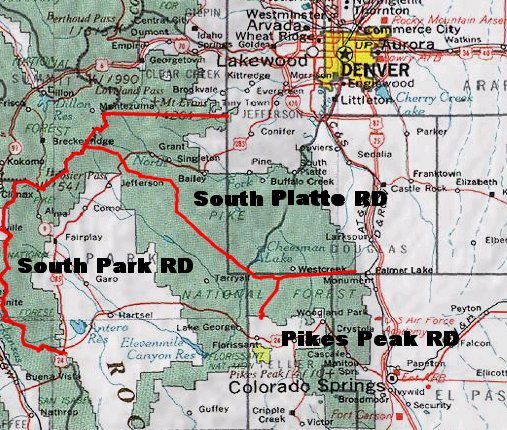
English: Map of Pike National Forest (green areas).
|
| Date | Unknown date |
| Source | http://www.fs.fed.us/r2/psicc/maps/pike_vicinity.jpg |
| Author | USDA |
Licensing
edit
This image is a work of the Forest Service of the United States Department of Agriculture. As a work of the U.S. federal government, the image is in the public domain.
|
File history
Click on a date/time to view the file as it appeared at that time.
| Date/Time | Thumbnail | Dimensions | User | Comment | |
|---|---|---|---|---|---|
| current | 21:55, 23 July 2007 | | 507 × 430 (102 KB) | Ken g6 (talk | contribs) | A map of the Pike National Forest. Sourced from [http://www.fs.fed.us/r2/psicc/maps/pike_vicinity.jpg this image], the picture was found on [http://www.fs.fed.us/r2/psicc/maps/pike.shtml this U.S.D.A. Forest Service web site]. |
You cannot overwrite this file.
File usage on Commons
The following page uses this file:
File usage on other wikis
The following other wikis use this file:
- Usage on de.wikipedia.org
- Usage on en.wikipedia.org
- Usage on es.wikipedia.org
- Usage on fa.wikipedia.org
- Usage on www.wikidata.org