File:Pilottown-LA.jpg
No higher resolution available.
Pilottown-LA.jpg (800 × 600 pixels, file size: 59 KB, MIME type: image/jpeg)
Captions
Captions
Add a one-line explanation of what this file represents
Summary edit
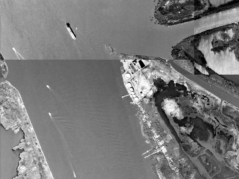
| Description | Aerial image of Pilottown, Louisiana, lower Mississippi River delta. |
| Date | |
| Source | USGS The National Map, via MSR Maps (formerly TerraServer-USA) |
| Author | United States Geological Survey (USGS) |
| Permission (Reusing this file) |
Public domain |
Previously uploaded to en:Wikipedia 19:05, 10 September 2005 by en:User:Interiot
Licensing edit
This image is in the public domain in the United States because it only contains materials that originally came from the United States Geological Survey, an agency of the United States Department of the Interior. For more information, see the official USGS copyright policy.
|
File history
Click on a date/time to view the file as it appeared at that time.
| Date/Time | Thumbnail | Dimensions | User | Comment | |
|---|---|---|---|---|---|
| current | 03:21, 6 July 2008 | | 800 × 600 (59 KB) | Infrogmation (talk | contribs) | == Summary == Satellite image of Pilottown, Louisiana. 24 January 1998 Image source: [http://terraserver-usa.com/image.aspx?T=1&S=12&Z=16&X=350&Y=4038&W=2 http://terraserver-usa.com/image.aspx?T=1&S=12&Z=16&X=350&Y=4038&W=2], credited to the [[:en:U |
You cannot overwrite this file.
File usage on Commons
There are no pages that use this file.
File usage on other wikis
The following other wikis use this file:
- Usage on en.wikipedia.org
- Usage on es.wikipedia.org